SHAWNEE, Okla. – Parts of Texas, Oklahoma, and Kansas were blasted by wild storms and tornadoes while heavy rain and snow blanketed much of California and parts of the West on Monday as belligerent weather marched menacingly across the nation.
A winter storm watch was in effect across much of the Northeast. And in Michigan, more than 157,000 homes and businesses remained in the dark Monday night after five days of high winds, snow and ice that wreaked havoc on power lines.
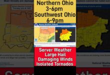
Elsewhere in the Midwest, a tornado watch was in effect Monday afternoon across much of Ohio as storms crossed the state. Portions of the Columbus metro area were under a tornado warning late Monday afternoon. There was a report of an unconfirmed tornado touchdown earlier Monday afternoon in Germantown, Ohio, about 15 miles southwest of Dayton, according to the National Weather Service.
Nine confirmed or suspected tornadoes swept through Kansas and Oklahoma late Sunday and early Monday, the National Weather Service reported. Texas was also blasted by storms that packed heavy winds and hail in some areas – a wind gust of 114 mph was reported in Memphis, Texas, 130 miles northeast of Lubbock. More than a dozen injuries were reported in the region.
“A lot of us didn’t get to get in (shelters), it was that quick,” said Dia Ingersoll, 42, hours after an apparent tornado raced through Shawnee, 40 miles east of Oklahoma City.

New York City braces for biggest snowfall of winter
While the heaviest snow is expected in parts of upstate New York and New England, New York City is predicted to have its largest snowfall so far for this winter.
New York City has yet to have measurable snow this winter but AccuWeather forecasters said precipitation was expected for the city Monday night.
As temperatures near the freezing mark, the precipitation will likely be a mix of snow, sleet, and rain which will continue overnight into Tuesday morning, AccuWeather said. Although the amount of snow will vary across the region, AccuWeather said about one to three inches of snow is expected in Manhattan and Central Park.
"While this is, historically, not a lot of snow for New York City, it will be noticeable, especially given the lack of snow for the city so far this season," said AccuWeather Senior Meteorologist Dave Dombek.
Oklahoma family never made it to storm cellar
Ingersoll, who has lived in her home for 17 years, said her roof has a hole in it where her chimney was torn away by the storm. She lost some shingles and a fence and outdoor furniture was damaged, she said. Next-door neighbors took significant damage; much of their roof is gone. Ingersoll said the home began to leak gas, leading emergency vehicles to shut off the neighborhood's gas and electricity.
Ingersoll has a storm cellar in the backyard, but she, her fiancé and her mother were still in their living room when the tornado struck. The family was watching news reports that a tornado had hit the nearby Shawnee Mall when "not but two minutes later it hit us."
“When the electricity went out my mother was stuck in her recliner," she said. "My fiance had to jump on top of her because right next to it is a plate glass sliding door."
Nevada braces for another foot of snow
In northern Nevada, many government offices were closed except for essential personnel. The winter storm was expected to hit the Reno area around 1 p.m. local time and drop a foot of snow atop the 6 inches that fell Sunday. Mountain areas were expecting substantially more.
Bethany Drysdale, who lives in Carson City, said she was driving to work in Reno on Monday morning but eventually turned around and decided to work from home because authorities were enforcing traction control laws on Interstate 580. The area averages about 300 days of sunshine a year, said Drysdale, a spokesperson for Washoe County.
"We usually don't have this quantity of snow this late. Schools are closed, roads are covered in snow and ice, and it's windy, which makes it worse," she said. "It feels odd to be going on two months of snow on the ground in Carson City."
Blizzard warning could lead to 'amazing powder days' at ski resort
California's Mammoth Mountain Ski Area was under a blizzard warning Monday, and managers warned of "intense" snowfall and high winds. The ski area sits at 11,000 feet above sea level in the Sierra Nevada mountain range and is rapidly approaching 500 inches of snowfall for the season. The resort got about 5 feet of snow last week and another 19 inches Sunday night, and 5 more feet is expected by Wednesday morning. Even before the winter ends – March is typically a snowy month – this season has been among the resort's snowiest on record.
"What a season," Mammoth spokeswoman Lauren Burke told USA TODAY. "The skiing and riding was incredible over the weekend, and while we expect limited lift operations the next few days, we are looking forward to some more amazing powder days later this week once this massive storm system moves out."

Downed power lines in Norman, home of the University of Oklahoma
Severe damage was reported in Norman, home to the University of Oklahoma, as winds and tornadoes swept through the area Sunday night.
"Tornado WARNING in effect for OU-NORMAN Campus," the school tweeted late Sunday. "Seek shelter NOW inside the building you are in. Move to lowest floor/interior room." Other tweets warned the school's more than 20,000 students to stay indoors and away from windows.
Gas leaks, downed power lines, and uprooted trees were reported in Norman, Mayor Larry Heikkila told AccuWeather.
Sylvie Mawoh was reading her two children a bedtime story in their east Norman home when it came time to take shelter. They took cover inside a master bedroom closet as the tornado passed overhead, leaving damage throughout their neighborhood.
"It was scary. It felt like the whole house was going to fly away," Mawoh said.
Statewide, Oklahoma officials received reports of 55 people who suffered weather-related injuries from area hospitals.
In western Oklahoma near the town of Cheyenne, at least one person was killed and three others injured after a tornado touched down Sunday night, Roger Mills County Emergency Manager Levi Blackketter reported.
Norman officials confirmed 12 weather-related injuries and classes were canceled Monday at two damaged elementary schools, said Norman Police Chief Kevin Foster.
California sees more snow, rain; travel 'near to impossible' in Sierra
Nearly all of California was experiencing rain or snow Monday morning. Southern California and other parts of the state got some relief Sunday from the stunning snow, record rain and flooding that hit over the weekend. But another storm is expected to last through midweek.
"A continuation of cold and unsettled conditions are expected along the West Coast through midweek this week as waves of energy and moisture dive in from the Pacific," AccuWeather Meteorologist Brandon Buckingham said.
Here are some of the latest developments:
- A blizzard warning was in effect for the Sierra Nevada. The region could see snow accumulations from 2 to 6 feet with wind gusts up to 75 mph. The National Weather Service says travel will be "near to impossible."
- Los Angeles County will have "cold and unsettled" weather through midweek, and the region will get up to an inch of rain. The San Fernando Valley got over 10 inches of rain over the weekend, and downtown Los Angeles had over 4 inches.
- Snow levels could drop as low as 1,000 feet above sea level, AccuWeather says.
- State officials were working through multiple highways closures around the Los Angeles area; snow could result in more closures.
AccuWeather senior meteorologist Adam Douty said the new storm this week "will not contain near as much moisture" as the preceding storm.
A BLIZZARD IN SOUTHERN CALIFORNIA: What to know about weird weather.

Winter storm warning in Great Lakes region; outages in Michigan
Freezing rain and snow were expected in parts of Minnesota, Wisconsin and Michigan.
"Bad: Additional freezing rain & ice accumulation expected Monday," the weather service tweeted. "Good: Accumulations should be less and stay north of ice storm impacted areas."
In Michigan, more than 157,000 homes and businesses remained without power in the state Monday, according to PowerOutage.US.
Heavy snow makes it way to Northeast
A winter storm watch went into effect Monday throughout the Northeast, and snow was likely from northeast Pennsylvania across the rest of the region.
Heavy snow – several inches to a foot – was possible in the following areas:
- High terrain of Vermont
- High terrain of New Hampshire
- Portions of Maine
- Upstate New York
There's a high risk of significant travel disruptions in upstate New York and much of the New England area, AccuWeather says.
Temperatures throughout the Northeast will be below freezing; highs will be in the low 30s.
Winter storm tracker
National weather radar
Contributing: Jessie Christopher Smith, The Oklahoman; The Columbus Dispatch; The Associated Press. Follow Jordan Mendoza on Twitter: @jordan_mendoza5.


