LIST: Several cities in Greater Cincinnati area issue snow emergencies due to winter storm
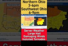
Hi, I'm Wlwt Meteorologist Randy Rico. Want to give you a 10 a.m. update on this winter storm? As we've been saying, this is coming in two rounds. The first one may seem a little bit underwhelming, but really it is the secondary round that comes in in the heart of the afternoon. And what would typically, on a non holiday, be a busy evening rush hour? So this morning, watching the back edge of round number one come through, it started about three o'clock this morning. We got a decent hit of heavy snowfall into our easternmost communities. People's came in with three inches of snow this morning. Other spots half inch inch. Pretty common, though this last little burst could add to that little that a little bit additional of accumulation. As we look into southern portions of Butler County, from Hamilton to Fairfield in Forest Park. This is drifting in the direction of Westchester and Mason and then on the southern part of the 2 75 loops. Same thing. Taylor Middle Highland Heights on in, through Eastgate and Milford. You're seeing that snow along the stretch of 75 south of Dry Ridge and moving in the direction of Pendleton County toward fell meth. This is a decent snowfall, enough to toss down Ah, quick half inch of snow. So this morning, most towns have picked up somewhere on the range of half inch inch, all the way up to three inches of snowfall. Then we let it be for a while. Let those road crews go through. I know it wasn't a huge snowfall this morning, but the roads aren't perfect. We have, ah lot of slush on the roads as we head through the late morning hours and into the lunch hour. So you can see from basically Louisville all the way back to Paducah. Not a whole lots going on. And that's kind of our break in the action. The recoup recover, maybe shovel away whatever snow you have from the early morning hours. Because the really heavy stuff is this batch that is moving up in through Arkansas and Memphis right now and headed in our direction in the evening. So the morning round is fading. It'll start to ramp up again in the mid afternoon to three o'clock and then I think, by four and 5 p.m. We're already seeing some of those heavier bands work into the area. Heaviest timeframe. If I had to pick one right now, it would be between four and 9 p.m. And then it looks like it does end midnight to about two o'clock in the morning. So by the numbers, this first round anywhere from a half inch up to three inches of snow and that secondary round specifically into the dinner time our and what would typically be an evening rush hour. 5 to 9 additional inches off snow. Ah, little bit lower than that, though, to the south and east, where there is the potential off seeing some sleet mixing in. So if you're kind of to the east of state, Route 62 on down in through portions of Mason County, Kentucky Southern Adams County. Those of the places where sleep a little bit more likely as we get into the afternoon and evening. The impact well at times with the snowfall rate over an inch an hour, that's mawr than a road crew can keep up with. And if you combo that within times 20 mile an hour wind gusts, you have slick, snow covered roads and reduced visibility. That's a combination that could create tricky, if not downright treacherous, travel this evening, which is why we have the winter storm warning along with the accumulating snow. So this afternoon around lunchtime, things are pretty quiet. I think they'll be a little action on the radar. Noon, but not much. 12 o'clock. Not a whole lot going on. But you can see as we head into the middle of the afternoon that snow over spreads the area and the darker the blue, the heavier the snowfall rate. You could even see by three o'clock some of those areas of atoms or Mason County, maybe bringing a little sleep into the picture as we head into the evening rush. Five and six PM noticed. There will be some spots where you're getting that rapid snowfall accumulation of over an inch per hour, and it continues through eight and 9 p.m. And then it starts to lighten up a little bit as we head toward 10 PM 11 PM midnight, and this whole thing moves out between midnight and around two o'clock in the morning. What we're left with tomorrow The cleanup, cold temperatures, breezy conditions for Tuesday morning and maybe some lingering flurries as well. So if you notice on the seven day forecast, we rarely issue weather warning days. That's when we turn the column here read on the seven day. But that's the case for today, especially with those travel impacts in through the evening and the first part of the overnight were dropping to 14 tonight and tomorrow, a couple of flurries dealing with the cleanup. Still, there's a breather Tuesday afternoon and Wednesday. But then, as we head into Wednesday night, another round of snow moves in. It looks like snow is likely through Thursday, and we have flurries lingering on Friday with the potential for a mix comes Sunday. So this system just getting started around one, almost over, and then we have a waiting game for Round two, which is the real story of this storm. So we'll have hourly updates for you on wlwt as we head through the afternoon. Yeah,
LIST: Several cities in Greater Cincinnati area issue snow emergencies due to winter storm
A messy winter storm is pushing through Cincinnati Monday, delivering two rounds of impactful snow to the region.Several cities have issued snow emergencies due to the impactful snow moving through the area.The initial round of snow has already started to move through the majority of the Greater Cincinnati area. Drivers are advised to use caution as the snow will be heavy at times and mixed with wind, will make visibility an issue on the roads.Most areas could see between one to three inches of snow with this initial round. There will be a break or a lull during the day Monday, before a heavy snow arrives in the evening and continues overnight into Tuesday. This is when the greatest accumulation will occur.The snow will pick back up around 2 p.m. and will be heavy through 11 p.m., bringing an additional 5 to 9 inches of snow for most areas.Currently, most of Greater Cincinnati is forecasted to receive between 9 to 12 inches of snow total by Tuesday.The snow looks heaviest from 2 p.m. until 11 p.m. This brings in an additional 5-9 inches of snow, 9-12 total for the day, for most, including the metro. Some in our far southeastern zones could see a wintry mix and sleet. This likely leads to totals closer to 4-8" for some southeast of I-71.Some areas in the far northwestern and southeastern regions could see closer to 4 to 8 inches total.In a level one snow emergency, drivers are advised to use caution due to dangerous road conditions. In a level two snow emergency only essential travel is advised due to extremely dangerous road conditions. In the event of a snow emergency, in some areas street parking is not permitted. Check with your city's snow emergency guidelines.Here are the latest snow emergencies that we have received in our area:SNOW EMERGENCIES IN OHIOHamilton County - Level 2 Snow Emergency Cheviot - Level 1 Snow Emergency Madeira - Level 1 Snow Emergency Monroe - Level 1 Snow Emergency Mt. Healthy - Level 1 Snow Emergency Reading - Level 1 Snow Emergency Springfield Township - Level 1 Snow Emergency Butler County - Level 1 Snow EmergencySNOW EMERGENCIES IN KENTUCKYBoone County - Level 2 Snow Emergency Crescent Springs - Level 1 Snow Emergency Crestview Hills - Level 1 Snow Emergency Covington - Level 1 Snow Emergency Fort Mitchell - Level 1 Snow Emergency Fort Wright - Level 1 Snow Emergency Edgewood - Level 1 Snow Emergency Elsmere - Level 1 Snow Emergency Kenton County - Level 2 Snow Emergency Lakeside Park - Level 1 Snow Emergency Silver Grove - Level 1 Snow Emergency Southgate - Level 1 Snow Emergency Taylor Mill - Level 2 Snow Emergency Villa Hills - Level 1 Snow EmergencySNOW EMERGENCIES IN INDIANADearborn County - Yellow Travel Advisory (Travel/activities restricted due to winter weather. Travelers should use caution.)
A messy winter storm is pushing through Cincinnati Monday, delivering two rounds of impactful snow to the region.
Several cities have issued snow emergencies due to the impactful snow moving through the area.
The initial round of snow has already started to move through the majority of the Greater Cincinnati area. Drivers are advised to use caution as the snow will be heavy at times and mixed with wind, will make visibility an issue on the roads.
Most areas could see between one to three inches of snow with this initial round.
There will be a break or a lull during the day Monday, before a heavy snow arrives in the evening and continues overnight into Tuesday. This is when the greatest accumulation will occur.
The snow will pick back up around 2 p.m. and will be heavy through 11 p.m., bringing an additional 5 to 9 inches of snow for most areas.
Currently, most of Greater Cincinnati is forecasted to receive between 9 to 12 inches of snow total by Tuesday.
The snow looks heaviest from 2 p.m. until 11 p.m. This brings in an additional 5-9 inches of snow, 9-12 total for the day, for most, including the metro. Some in our far southeastern zones could see a wintry mix and sleet. This likely leads to totals closer to 4-8" for some southeast of I-71.
Some areas in the far northwestern and southeastern regions could see closer to 4 to 8 inches total.
In a level one snow emergency, drivers are advised to use caution due to dangerous road conditions.
In a level two snow emergency only essential travel is advised due to extremely dangerous road conditions.
In the event of a snow emergency, in some areas street parking is not permitted. Check with your city's snow emergency guidelines.
Here are the latest snow emergencies that we have received in our area:
SNOW EMERGENCIES IN OHIO
- Hamilton County - Level 2 Snow Emergency
- Cheviot - Level 1 Snow Emergency
- Madeira - Level 1 Snow Emergency
- Monroe - Level 1 Snow Emergency
- Mt. Healthy - Level 1 Snow Emergency
- Reading - Level 1 Snow Emergency
- Springfield Township - Level 1 Snow Emergency
- Butler County - Level 1 Snow Emergency
SNOW EMERGENCIES IN KENTUCKY
- Boone County - Level 2 Snow Emergency
- Crescent Springs - Level 1 Snow Emergency
- Crestview Hills - Level 1 Snow Emergency
- Covington - Level 1 Snow Emergency
- Fort Mitchell - Level 1 Snow Emergency
- Fort Wright - Level 1 Snow Emergency
- Edgewood - Level 1 Snow Emergency
- Elsmere - Level 1 Snow Emergency
- Kenton County - Level 2 Snow Emergency
- Lakeside Park - Level 1 Snow Emergency
- Silver Grove - Level 1 Snow Emergency
- Southgate - Level 1 Snow Emergency
- Taylor Mill - Level 2 Snow Emergency
- Villa Hills - Level 1 Snow Emergency
SNOW EMERGENCIES IN INDIANA
- Dearborn County - Yellow Travel Advisory (Travel/activities restricted due to winter weather. Travelers should use caution.)
Source link


