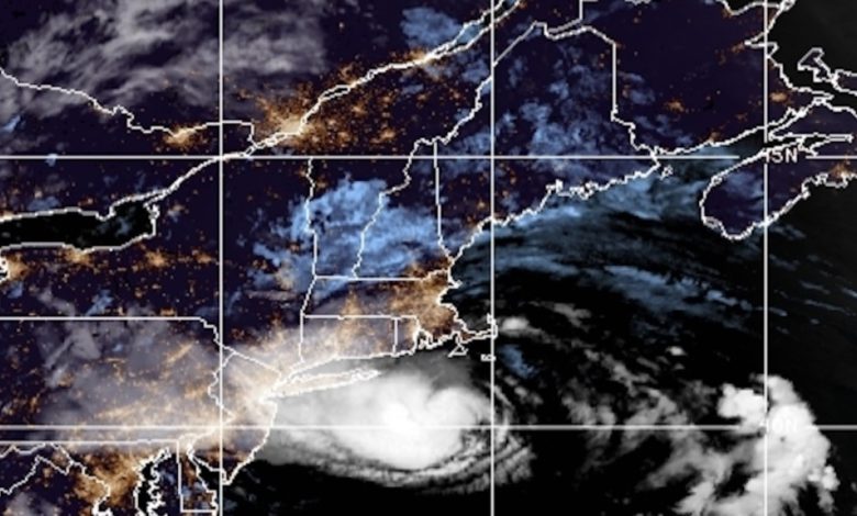
Henri made landfall as a tropical storm Sunday afternoon near Westerly, Rhode Island, the National Hurricane Center reports.
According to the NHC, the storm reached southern New England Sunday afternoon around 12:15 p.m. ET, packing maximum sustained winds of 60 mph.
Portions of Rhode Island, Connecticut and Massachusetts have been experiencing tropical storm conditions throughout the morning on Sunday. According to PowerOutage.us, there were about 100,000 customers without power in Rhode Island and Connecticut as of about 12:45 p.m. ET.
The NHC projects that in the coming hours, the storm will continue to move northward into Massachusetts, Vermont, New Hampshire and Maine before moving eastward and back out to sea.
The NHC also says that southeast New York and northern New Jersey could be in for "considerable" flash and urban flooding, as well as small stream and river flooding throughout the weekend.
On Saturday afternoon, New York Gov. Andrew Cuomo declared a state of emergency in parts of the state in Henri's path and urged those in the state to take hurricane warnings seriously.
Across the East Coast, Henri will cause beaches and ocean ports to experience dangerous swells and significant rip tide currents.
At a press conference on Sunday, President Joe Biden urged New Englanders to remain vigilant and follow the guidance of local leaders. He also added that he had declared disaster declarations in Rhode Island, Connecticut and New York. He also encouraged Americans to wear masks and social distance if possible amid evacuations and encouraged other Americans to seek out vaccines in advance of potential natural disasters later this year.
Henri is poised to become one of the most powerful storms to make landfall in New England in 30 years. In 1991, Hurricane Bob made landfall in the area, where the AP says it killed 17 people and caused $1.5 billion in damage.


