TIMELINE: 1 inch of snow possible overnight, into morning commute
INAUGURATION. SHEREE: COULD BE A LITTLE SLICK AND EVEN SNOW WAY AS YOU HEAD OUT TOMORROW. MIKE: THIS WAS THE FIRST TIME THIS MORNING WE THREW SALTED DOWN ON THE SIDEWALK. THIS IS DANGEROUS. ALLISON: WHAT IS MOVING IN HERE TONIGHT WILL BE DIFFERENT THAN WHAT WE HAVE SEEN OVER THE PAST COUPLE OF DAYS. WE ARE WATCHING RIGHT NOW AS SOME LIGHT SNOW WILL BEGIN THROUGH THE 71 SPLIT. A LITTLE BIT OF A WINTRY MIX. CARROLL COUNTY, OWEN COUNTY, AND EVENTUALLY WE WILL START TO SEE THIS MORE WIDESPREAD. THIS ALL WILL BE MOVING INTO CINCINNATI HERE. I WOULD SAY RIGHT AROUND 1:00 OR 2:00 IN THE MORNING. AS IT MOVES OUT, IT’S GOING TO BE A THIN, NARROW BAND OF SNOW. BY 2:00 IN THE MORNING, SOUTH OF THE OHIO RIVER, SOME SPOTS INTO INDIANA, SOUTH OF 74, WILSEY SNOWFALL AS WELL. THIS LINE COULD BE AS FAR NORTH AS CINCINNATI BUT THE MAJORITY OF THE SNOW WILL BE CONCENTRATED SOUTH OF THE OHIO RIVER AND AROUND THE OHIO RIVER, TOO. 7:00 IN THE MORNING, WE STILL HAVE SOME SNOW AROUND THE AREA. IF YOU LIVE NORTH OF THE LOOP, YOU COULD SEE A FLURRY OR TWO. ABOUT AN INCH OR SO SOUTH OF THE RIVER TOMORROW MORNING. 9:00 A.M., THE SNOW IS MOVING OUT OF HERE. JUST ENOUGH SUNSHINE THAT HIGH TEMPERATURES REACH INTO THE UPPER 30’S. WHATEVER SNOW WE DO GET IS LIKELY TO MELT AWAY BY TOMORROW AFTERNOON. THOSE AREAS THAT LOOK LIKE THEY WILL SEE THE MAJORITY OF THE SNOW. NORTHERN KENTUCKY AND ADAMS COUNTY INTO OHIO. THIS ADVISORY GOES INTO EFFECT AT MIDNIGHT, LASTING UNTIL ABOUT NOON TOMORROW. TOTALS GENERALLY WILL BE RIGHT AROUND AN INCH IF NOT A LITTLE BIT BELOW. WE COULD SEE A COUPLE OF SLICK SPOTS OF THE MORNING, SOME SLOWDOWNS AS WELL. ESPECIALLY FARTHER SOUTH. SOUTH OF THE 275 LOOP IS AN AREA I AM POTENTIALLY LOOKING AT TO SEE SOME TRAVEL IN THE MORNING. SNOW COULD BE A POSSIBILITY FOR SOME OF OUR SOUTHERN COMMUNITIES. TEMPERATURES -- PAVEMENT TEMPERATURES GENERALLY ABOVE FREEZING BUT TONIGHT I AM EXPECTING THEM TO DROP DOWN TO THE 20’S. AGAIN, WATCHING OUT FOR SOME OF THOSE SLICK SPOTS TO FORM. TONIGHT, OUR LOW WILL BRING US TO RIGHT AROUND 29 DEGREES. TOMORROW WILL BE A WEATHER IMPACT A. THURSDAY IS GOING TO BE THE DAY. 37 FOR THE HIGH TEMPERATURE IN A LITTLE BIT OF SUNSHINE EVERY NOW AND THEN. SH
TIMELINE: 1 inch of snow possible overnight, into morning commute
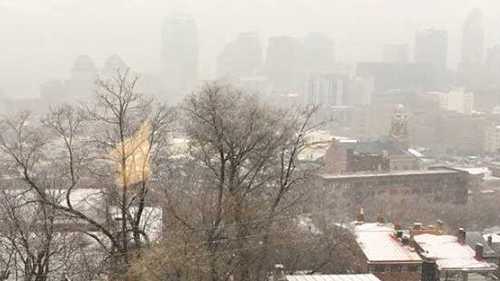
Accumulating snow is coming overnight. And while it’s not a lot, the timing could be problematic for some. A winter weather advisory has been issued for several counties.LIVE RADAR // LATEST WEATHER ALERTSA narrow band of snow moves in from Missouri around midnight or just after. Lows drop to the upper 20s with snow moving in from west to east.A winter weather advisory goes into effect at midnight, lasting until noon Tuesday.The system will be around for the morning drive. It looks like an inch of accumulation for areas along and south of the Ohio River. While it isn't a lot, the timing could make this an issue. Watch for slick spots and potentially snow-covered roads that go untreated.The snow will be gone by 9 a.m. While sunshine has been in short supply (for seemingly weeks!), we could see a few peeks by Tuesday afternoon and then daily from Wednesday through Saturday.Below-normal temperatures--in the mid-30s--will continue through midweek before a Thursday warm-up when the mercury will climb into the mid-40s.
Accumulating snow is coming overnight. And while it’s not a lot, the timing could be problematic for some.
A winter weather advisory has been issued for several counties.
LIVE RADAR // LATEST WEATHER ALERTS
A narrow band of snow moves in from Missouri around midnight or just after. Lows drop to the upper 20s with snow moving in from west to east.
A winter weather advisory goes into effect at midnight, lasting until noon Tuesday.
The system will be around for the morning drive. It looks like an inch of accumulation for areas along and south of the Ohio River. While it isn't a lot, the timing could make this an issue. Watch for slick spots and potentially snow-covered roads that go untreated.
The snow will be gone by 9 a.m. While sunshine has been in short supply (for seemingly weeks!), we could see a few peeks by Tuesday afternoon and then daily from Wednesday through Saturday.
Below-normal temperatures--in the mid-30s--will continue through midweek before a Thursday warm-up when the mercury will climb into the mid-40s.
Source link


