- Several feet of snow have already fallen in some areas around Buffalo.
- Winter weather has been blamed for several deaths and caused scattered power outages.
- Storms are expected to continue through Sunday.
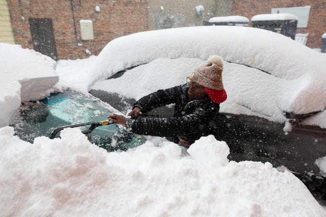
Parts of western New York state were buried under several feet of snow Saturday morning, with lake-effect snowstorms blamed for multiple deaths, scattered power outages and icy roads that stymied first responders as severe squalls continued to blast the area.
Storms that whipped eleven counties into a state of emergency Friday are expected to continue through Sunday, dumping as much as four feet of snow in parts of the Buffalo metro area before mixing with rain on Monday, according to the National Weather Service. In some areas, six or more feet were already on the ground Saturday.
The heaviest snow fell south of the city, with single-day totals ranging from three feet along the Lake Erie’s eastern end to as much as 66 inches in suburban Orchard Park, where the Buffalo Bills were scheduled to play the Cleveland Browns on Sunday. NFL officials on Thursday announced that they were moving the game to Detroit’s Ford Field because of the weather.
Erie County executive Mark Poloncarz said in a tweet that two people had died as a result of the storm from “cardiac events related to exertion during shoveling/snow blowing." A third person – a snowplow driver in Hamlet, Indiana, about 30 miles from Lake Michigan – was killed Friday when his plow slid off the pavement and rolled over, the Starke County Sheriff's Department.
How does climate change affect you?: Subscribe to the weekly Climate Point newsletter
Gov. Kathy Hochul has activated the National Guard to assist with emergency response in the area, Poloncarz added.

Meanwhile, treacherous weather conditions prompted Buffalo officials to issue travel bans throughout the area. However, the Buffalo News reported as of Friday evening officers had issued more than 300 tickets to drivers who defied those bans.
Throughout the area, a mishmash of lake-effect snowfall blanketed neighborhoods as residents dug out and hoped their rooftops wouldn’t buckle under the weight.
Lake-effect storms are created when frigid winds collect moisture from warmer lakes, forming narrow bands of clouds that dump blowing snow wherever currents may take them. The patchwork effect means some areas of Buffalo experienced heavy thundersnow, in which storms dispense snow instead of rain, while others saw more modest snowfall with patches of blue sky.
Buffalo's National Weather Service office said that the nearly 14 inches that had fallen at Buffalo Niagara International Airport through Saturday morning meant more than 29 inches of snow had fallen there this month, making it — so far — the third snowiest November on record. The snowiest was 45.6 inches in 2000, the office said.
Photos posted by the Buffalo Bills on social media showed Highmark Stadium and its more than 60,000 seats virtually buried in snow, and CBS News posted video of a snowplow helping another plow that had gotten stuck in the snow.
Scott Fleetwood of West Seneca captured video of lightning crashing outside his home throughout the night, as well as snow swiftly burying the pumpkins on his porch.
“The sky is white.... Everything’s white. The only thing you can see really is the house across the street,” he said. “My tiki bar is now an igloo."
Buffalo has experience with dramatic lake-effect snowstorms, few worse than the one that struck in November 2014. That epic storm dumped 7 feet of snow on some communities over three days, collapsing roofs and trapping motorists in more than 100 vehicles on a lakeside stretch of the New York State Thruway.

Hochul declared a state of emergency Thursday for parts of western New York, including communities along the eastern ends of Lake Erie and Lake Ontario. The declaration covers 11 counties, with all vehicles banned from a stretch of Interstate 90.
Contributing: Ashley R. Williams and Doyle Rice USA TODAY; The Associated Press.


