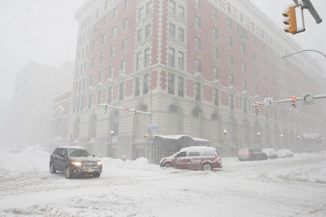
A lake-effect snowstorm dumped multiple inches of snow over western New York Friday, with snowfall totals expected to reach at least 4 feet through Sunday in the Buffalo area.
The storm was blamed for the deaths of two people stricken with "cardiac events" while clearing snow.
Eleven counties remained under a state of emergency Friday as an intense snow band whipped the area.
New York state's Twitter account shared a photo of a yardstick buried in 19 inches of snow in South Cheektowaga west of Buffalo shortly before sunrise. "Continue to stay off the roads and stay safe," the tweet read.
Weather Channel meteorologist and storm chaser Jim Cantore, who was in the Buffalo area Friday, tweeted a picture of a yardstick showing 32 inches of snow "and counting" for nearby Hamburg, New York.
"Whether Buffalo city gets 4 feet or not is irrelevant," the famed weather forecaster told Erie County executive Mark Poloncarz on Thursday. "You're gonna get something. I mean, Erie is gonna get crushed, as we know."
How does climate change affect you?: Subscribe to the weekly Climate Point newsletter
The storm was blamed for two deaths, Poloncarz said, tweeting they were "associated with cardiac events related to exertion during shoveling/snow blowing."
The storm's severity varied widely due to the peculiarities of lake-effect storms, which are caused by frigid winds picking up moisture from warmer lakes and dumping snow in narrow bands.
Residents in some parts of Buffalo spent Friday buffeted by blowing, heavy snow, punctuated by occasional claps of thunder, while just a few miles north, only a few inches fell and there were patches of blue sky.
BUFFALO SNOW IN GRAPHICS:Snowfall totals in the Buffalo area and what causes lake-effect snow

Here’s what to know about the snowstorm:
How much snow is Buffalo getting?
Southern Buffalo was experiencing snowfall rates up to 5 inches per hour Friday in the heaviest part of the snow band, according to AccuWeather senior meteorologist Paul Walker.
The heaviest snowfall was south of the city. The National Weather Service reported single-day totals of 3 feet in many places along the eastern end of Lake Erie, with bands of heavier precipitation bringing 66 inches in the Buffalo suburb of Orchard Park, 48 inches in Elma and more than 3 feet in Hamburg, where rescue crews were called to help a resident whose home buckled under the weight.
At Buffalo Niagara International Airport, where scheduled arriving and departing flights were canceled, the NWS observed 13 inches of snow Friday morning.
A trained weather spotter measured 48 inches of snow Friday afternoon in Blasdell about 9 miles south of Buffalo, the NWS reported.

Thundersnow hits Buffalo as lake-effect snow warning continues
Thundersnow, which happens when a thunderstorm drops snow rather than rain, was reported throughout Thursday night in Buffalo over several hours, according to the National Weather Service. The NWS said thundersnow would continue Friday.
Heavy, wet snow brought down trees and caused isolated power outages across the Buffalo area, Poloncarz said.
WHAT IS THUNDERSNOW? Explaining how a thunderstorm can produce snow
Meanwhile, a lake-effect snow warning continued Friday across Erie County.
"The biggest problems with lake-effect snow is that it builds up on roofs and can cause them to collapse under the weight of the snow, and not to mention the loss of power," Walker told USA TODAY.
The warning was expected to change to a winter storm watch for southern Erie County by Saturday, Jurkowski said.
"When the snow band drifts up to Niagara County on Saturday, it will drift back south Saturday night, so when that comes down, there’s a possibility for up to 9 inches more (snow)," Jurkowski said.
LAKE-EFFECT SNOW, EXPLAINED: How it happens and how much snow it can bring
Buffalo travel ban in effect for some areas amid 'treacherous' driving conditions
Erie County on Thursday issued a ban on travel for nonemergency vehicles. On Friday, it was downgraded to a travel advisory for Buffalo, though the ban remained in place for other parts of the county, Poloncarz said.
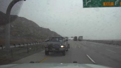
"Roads are slick and snow covered, and in this band, there's zero visibility," Jurkowski told USA TODAY.
"There are winds that are helping blow that around, limiting visibility," said Jurkowski, who called current Buffalo-area driving conditions "treacherous and horrible."
Several roads were closed, including parts of the New York State Thruway, due to unsafe conditions. The Hamburg District in Erie County reported drivers getting stuck on "very dangerous" roads as several plow drivers worked to clear snow.
By Friday afternoon, AAA tow truck drivers were having trouble reaching dozens of stranded drivers who defied travel bans and advisories, association spokeswoman Elizebeth Carey said.
"The AAA crews were trying to get to people that had called in saying they were broken down or stranded or had gone off the road in their vehicle. ... A lot of our tow truck drivers kept calling in saying that 'police turned me away,'" she said. In some cases, tow trucks followed behind payloaders enlisted to clear the way. The AAA passed along other drivers' locations to police.

Buffalo webcam: Watch live
This weekend's snow forecast for Buffalo
Lake-effect snow and intense squalls were expected to continue through Friday night and late Saturday, Walker said.
“There could be some shifting of these bands, so it won’t be the same place that will get it all the time, but it looks like there will continue to be some bands of snow coming off the lake tomorrow into Sunday,” Walker said.
Snowfall amounts were projected to reach 4 feet, according to the NWS. “We’re still on track for that,” Jurkowski said.
Contributing: Victoria E. Freile, Democrat and Chronicle; Doyle Rice, USA TODAY; The Associated Press


