Cincinnati officials give update on preparations ahead of winter storm

Updated: 10:13 AM EST Dec 22, 2022
RANDI: AND IF THE KIDS WANT TO PLAY IN THE SNOW IT WILL BE SO COLD. FOR KIDS THAT WANT TO PLAY IN IT, WAIT UNTIL NEXT WEEK. KELLY: IT’S NOT GOING ANYWHERE. I THINK THAT WAS THE OTHER THING PEOPLE KNOW WHAT IS HAPPENING TODAY AND NOW THEY GO WHEN IT IS GOING -- WHEN IS IT GOING TO VOTE OR GET? WE ARE LOOKING AT NEXT WEEK. NEXT TUESDAY. RANDI: IT’S LATE IN THE SEVEN-DAY BEFORE WE SEE TEMPERATURES ABOVE FREEZING SO ONCE THE SNOW GETS HERE IT HAS TO BE MOVED AWAY. AND AGAIN, SNOW IS NOT OUR BIG HEADLINE. THERE WILL BE SNOW AND WHILE THE SNOW IS FALLING A QUICK CLIP TONIGHT, VISIBILITY WILL BE DOWN. THAT IS WHY OVERNIGHT HOURS ARE PROBABLY THE WORST TO BE ON THE ROADS. THIS MAJOR ARCTIC BLAST IS A PRETTY DYNAMIC STORM. A LOT OF DIFFERENT FEATURES WITHIN FROM THE RAPIDLY FALLING TEMPERATURES FROM THE RAIN TO SNOW AND THEN THE WIND CHILLS ALL THE WAY WITH THROUGH CHRISTMAS MORNING. DO THE DAY TODAY YOU HAVE DAYTIME HOURS TO RUN YOUR ERRANDS, GET THINGS DONE, RAINING OFF AND ON AND TEMPERATURES IN THE MID 40’S. GET TO WHERE YOU ARE GOING BY ABOUT 8:00 TONIGHT BECAUSE THIS EVENING THE ARCTIC FRONT BARGES IN AND IT WILL BE SHOCKING HOW QUICKLY THE TEMPERATURES DROP SO WE WILL GO FROM RAIN TO SNOW AND OBVIOUSLY INITIALLY THE FIRST LITTLE BIT OF SNOW WILL MELT ON CONTACT. WE HAVE HAD RAIN FOR THE DAY SO THE ROADS ARE WET AND ROAD CREWS CANNOT PRETREAT WHEN IT IS RAINING FIRST. THEN YOU HAVE A LITTLE SNOW THAT MELTS ON CONTACT AND THE ROADS ARE STILL WET BUT THE DROP IN TEMPERATURE IS SO DRAMATIC THAT IT FLASH FREEZES SO THE WATER ON THE ROADS TURNS TO ICE. THEN YOU HAVE RAPIDLY ACCUMULATING SNOW ON TOP OF THAT COMBINED WITH STRONG WINDS WHICH REDUCE THE VISIBILITY. ALL OF THAT COMBINES TO MAKE TREACHEROUS TRAVEL CONDITIONS, ESPECIALLY THROUGH THE OVERNIGHT HOURS. TEMPERATURES WILL BE FOLLOWING SO IF YOU GET STRANDED ON THE ROADS, WHEN CHOSE THIS TIME TOMORROW MORNING ABOUT 30 BELOW ZERO. HERE IS THE OVERNIGHT, TWO TO FOUR INCHES EXPECTED, FALLING VERY RAPIDLY AND A SHORT TIMEFRAME WITH OF INTENTIONAL OF 40 MILE-PER-HOUR WIND GUSTS. SOME WHITE OUT CONDITIONS WILL BE POSSIBLE, ESPECIALLY 10:00, 11:00, MIDNIGHT, 1:00 A.M. MIDNIGHT IS PROBABLY THE WORST FOR TRAVEL. BY THIS TIME TOMORROW MORNING, THE SNOW IS DONE. IT IS MOVING OUT. WE WILL HAVE BLOWING SNOW COURTESY OF THE VERY GUSTY WINDS BUT TOMORROW’S BIG IMPACT, THE FEELS LIKE TEMPERATURES AS ROAD CREWS WORK HARD TO GET RID OF THE SNOW AND ICE FROM OVERNIGHT. IT WILL FEEL LIKE 20 TO 30 DEGREES BELOW ZERO THROUGH THE DAY FRIDAY. INTO SATURDAY, IT IS STILL VERY COLD. WIND DRILLS STARTING AROUND 20 DEGREES -- WIND CHILL STARTING AROUND 20 DEGREES. DOING FINE BELOW THE AFTERNOON. FUTURECAST SHOWING RAIN SHOWERS MOVING IN. SPRINKLES ALREADY FALLING OUTSIDE THIS MORNING AND YOU CAN SEE THE RAIN PICKS UP. FOR THE MORNING COMMUTE, DON’T WORRY, THE ROADS ARE WET. IT IS STRAIGHT AT THE WAY. TEMPERATURES THIS AFTERNOON WILL MAKE IT TO THE MID-40’S, GET A LITTLE BREAK IN THE ACTION AND THINGS ARE OK INTO THE DINNER HOUR TONIGHT. 4:00 AND 5:00 P.M., THE RAIN BECOMING MORE STEADY BUT WATCH HOW QUICKLY THE LINE RACES ACROSS GREATER CINCINNATI. BY THE TIME WE GET TO THE 7:00 HOUR, WE START TO SEE THE RAIN SNOW CHANGE OVER IN SOUTHEASTERN INDIANA. TOWARD 8:00, STARTING TO SEE THAT HAPPEN INSIDE OF THE 275 LOOP AND FOR THE MAIN AREA HIGHWAYS AND AFTER 10:00 OR 11:00 FOR THE EASTERN COMMUNITIES BUT WE SEE THE RAPID CHANGE OVER SNOW AND SEE HOW QUICKLY THE SNOW IS FALLING? THE DEEPER BLUES INDICATING HEAVIER SNOWFALL RATE AND THAT WILL BE COUPLED WITH 40 MILE-PER-HOUR GUSTS. THAT IS WHY WHITEOUT CONDITIONS ARE A GOOD POSSIBILITY FOR US, RIGHT IN THE MIDDLE THE NIGHT. THE SNOW CONTINUES TO COME DOWN THROUGH 5:00 A.M. TOMORROW MORNING THAT MOVES OUT AND WE ARE LEFT WITH TWO TO FOUR INCHES OF SNOW ON THE GROUND FOR MOST OF US. SOME SPOTS COULD SEE UP TO FIVE BUT IT IS A RAPIDLY ACCUMULATING SNOW COUPLED WITH STRONG WINDS, NEAR WHITEOUT CONDITIONS, AND TOMORROW THOUGH THERE IS NO MORE SNOW FALLING FROM THE SKY, BLOWING SNOW COULD CAUSE SLICK SPOTS EVEN AFTER ROAD CREWS HAVE DONE THEIR JOB. WIND CHILL CONCERNS STICK WITH US LONGER. YOU CAN SEE FRIDAY, FOUR DEGREES BELOW ZERO IS THE ACTUAL AIR TEMPERATURE AT 8:00 A.M. AND IT WILL FEEL 30 BELOW AND KEEPING THE WIND SHOWS ABOUT 25 BELOW THROUGH THE DAY, SATURDAY, NOT MUCH OF AN OF ROOMMATE, STAYING WITH TEMPERATURES NEAR ZERO AND WHEN CHOSE BELOW ZERO. I AM EXPECTING THE FEELS LIKE TEMPERATURE TO GO BACK INTO THE POSITIVES ABOVE ZERO MID CHRISTMAS DAY. FOR TODAY, WEATHER WARNING DAY, DAYTIME SHOWERS, EVENING SNOW AS TEMPERATURES FALL SO QUICKLY. WE DROPPED TO NEGATIVE FOUR OVERNIGHT AND YOU CAN SEE THE IMPACT IT WILL HAVE ON YOUR TRAVEL TONIGHT AND AT LEAST THROUGH THE FIRST PART OF THE DAY FRIDAY. I DISSIPATE THINGS LOOKING BETTER BY SATURDAY AND SUNDAY, IT IS A COLD AND EASY D
Cincinnati officials give update on preparations ahead of winter storm
Updated: 10:13 AM EST Dec 22, 2022
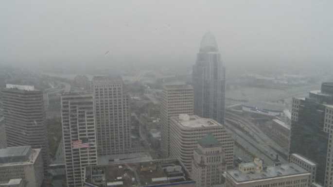
Cincinnati officials gave an update Thursday morning on preparations ahead of the dangerous winter storm set to move through Cincinnati.Watch the full press conference in the video player aboveJarrod Bolden, Department of Public Services Traffic and Road Operations Division Superintendent, said they plan to have 115 plow drivers out on the roads starting at 7 p.m.Bolden said drivers will be working in 12-hour shifts around the clock ready to address road conditions.He said while the way the storm is moving in, with rain before snow, it could make it difficult to pre-treat roads, but drivers will be ready to act at any time and will be flexible to adjust to road conditions s they change.Bolden encouraged those who can stay home to do so and those who are traveling to give yourself extra time on the roads."We're going to continue to work around the clock until all the streets are safe," Bolden said.SEE LATEST CLOSINGS HERE // SEE WEATHER ALERTS HEREA winter storm warning has been issued for much of the Greater Cincinnati area.Expect off-and-on showers through the day Thursday. It will be breezy with highs in the mid-40s.All travel should be wrapped up 8 p.m. Thursday evening and you should be where you are going to be to ride out this storm. An impressive display of weather is expected Thursday evening as the arctic cold front arrives. Temperatures will fall from the mid-40s early evening to the single digits by midnight! This will also fuel strong winds with the potential for power outages as winds gust 40-50mph. This combined with falling snow will likely make travel very difficult if not impossible. Snow will end area wide before sunrise Friday morning. Wind chills will drop to 25-30 below zero by Friday morning. Frostbite can happen in less than 30 minutes. Wind chills will stay 15-20 below zero all day!Snowfall amounts of 2-4 inches possible with up to 5 possible. The rate and wind will make for an impressive snow event on top of a flash freeze so roads will likely be nasty and stay that way much of Friday. A blizzard remains a real possibility.Wind chills will stay below zero through Christmas afternoon.
Cincinnati officials gave an update Thursday morning on preparations ahead of the dangerous winter storm set to move through Cincinnati.
Watch the full press conference in the video player above
Jarrod Bolden, Department of Public Services Traffic and Road Operations Division Superintendent, said they plan to have 115 plow drivers out on the roads starting at 7 p.m.
Bolden said drivers will be working in 12-hour shifts around the clock ready to address road conditions.
He said while the way the storm is moving in, with rain before snow, it could make it difficult to pre-treat roads, but drivers will be ready to act at any time and will be flexible to adjust to road conditions s they change.
Bolden encouraged those who can stay home to do so and those who are traveling to give yourself extra time on the roads.
"We're going to continue to work around the clock until all the streets are safe," Bolden said.
SEE LATEST CLOSINGS HERE // SEE WEATHER ALERTS HERE
A winter storm warning has been issued for much of the Greater Cincinnati area.
Expect off-and-on showers through the day Thursday. It will be breezy with highs in the mid-40s.
All travel should be wrapped up 8 p.m. Thursday evening and you should be where you are going to be to ride out this storm. An impressive display of weather is expected Thursday evening as the arctic cold front arrives. Temperatures will fall from the mid-40s early evening to the single digits by midnight! This will also fuel strong winds with the potential for power outages as winds gust 40-50mph. This combined with falling snow will likely make travel very difficult if not impossible. Snow will end area wide before sunrise Friday morning. Wind chills will drop to 25-30 below zero by Friday morning. Frostbite can happen in less than 30 minutes. Wind chills will stay 15-20 below zero all day!
Snowfall amounts of 2-4 inches possible with up to 5 possible. The rate and wind will make for an impressive snow event on top of a flash freeze so roads will likely be nasty and stay that way much of Friday. A blizzard remains a real possibility.
Wind chills will stay below zero through Christmas afternoon.
Source link