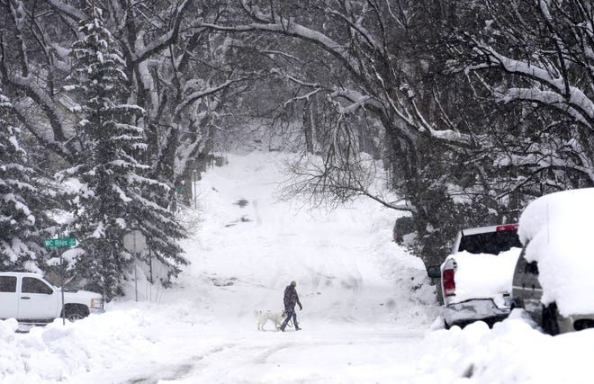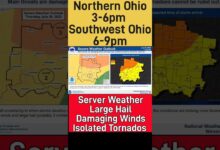
Colorado, Nebraska and other parts of the central U.S. are facing a major snowstorm Wednesday that has already broken records in Arizona – and it could cross more than 1,700 miles of the country.
Swaths of the eastern Rockies, the Plains, and the upper Midwest were under winter storm warnings and winter weather advisories Wednesday, and parts of Nebraska could see additional snow accumulations of up to 17 inches.
The National Weather Service had issued a winter storm warning for nine states as of Wednesday morning.
The storm could move all the way to parts of Michigan. Areas in the northern part of the state are under a winter storm watch, which will remain in effect until Thursday night.
"Heavy snowfall rates and some icing will create dangerous travel in many areas," the weather service said Wednesday.
Problem solved:How to quickly defrost your icy car windshield
Are you too old to shovel snow? If you're over 45, beware of heart attacks, doctor says
Here’s what you need to know as winter weather intensifies this week:
How far will the winter weather spread?
The National Weather Service on Wednesday afternoon said the winter storm over the "Central Plains will track into the Great Lakes by Thursday with a mixture of heavy snow, sleet, and freezing rain.
Snow and ice are set to spread into the Northeast on Thursday and continue into Friday.
The weather service also warned that heavy snowfall rates in Nebraska, Michigan and other states "combined with winds gusting up to 35 mph will result in dangerous travel due to blowing snow with near-zero visibility at times."
21-vehicle pileup closes Colorado interstate
A major accident involving nine semi-trucks and 12 passenger vehicles shut down a section of Interstate 70 in Colorado Wednesday afternoon.
The multi-vehicle crash closed down about a 160-mile stretch of the interstate, from Airpark Road in Aurora, Colorado, to the Kansas state line in both directions.
No injuries have been reported, according to the Colorado State Patrol. The state patrol said troopers on the scene believe it will take until Thursday morning to clear the accident but there is an unknown timeframe for when the interstate will reopen.
"Alternate routes not encouraged in the area because they will still be dangerous due to high winds and slick roads," the Colorado State Patrol said Wednesday.
The weather service in Boulder, Colorado, warned that poor visibility in addition to drifting and blowing snow will linger over the northeast plains through Wednesday night.
What winter weather can Michigan expect?
The National Weather Service in Gaylord, Michigan, on Wednesday afternoon said heavy snow is likely, with snow accumulations of 4 to 8 inches expected in the area.
The heaviest snow is expected on Thursday morning.
Winds will also likely "gust to between 30 and 40 mph," according to the weather service.
"Plan on snow-covered and slippery road conditions," the weather service shared. "The hazardous conditions will likely impact the morning and evening commutes."
Where will the winter storm hit? Colorado, Nebraska, Iowa stare down snow
The storm has stretched over the Four Corners region and is continuing to impact Omaha, Nebraska; Des Moines, Iowa; Green Bay, Wisconsin, stretching into and even covering parts of Michigan by Thursday, according to AccuWeather and the National Weather Service.
Denver had recorded more than 7 inches of snow by 5 a.m. local time Wednesday, and totals were expected to rise, the Denver Post reported. Fort Collins, Colorado, received 4 to 5 inches of snow as of Wednesday morning, according to Community Collaborative Rain, Hail and Snow Network reports.
Record-breaking snowfall in northern Arizona
More than 2 feet of snow fell over two days across parts of northern Arizona, becoming the 25th largest snow event in Flagstaff history and breaking the record for single-day snow accumulation on Sunday.

The Flagstaff Airport measured 14.8 inches on Sunday, smashing the previous record of 8.9 inches that was held for 45 years. As the snow continued to fall, accumulation eventually reached 30 inches at the airport by Tuesday morning.
Another storm is in the forecast later this week and could bring an extra 4 to 5 inches of snow to Flagstaff.
How much snow should Colorado expect?
Different cities in Colorado will see different snow accumulations. Here is the weather service’s forecast for the coming days, as of Tuesday:
- Fort Collins: 8-12 inches
- Greeley: 8-12 inches
- Estes Park: 6-8 inches
- Red Feather Lakes: 8-12 inches
- Boulder: 8-12 inches
- Denver: 8-12 inches
- Denver International Airport: 8-12 inches
- Fort Morgan: 8-12 inches
- Sterling: 8-12 inches
- Julesburg: 12-18 inches
- Holyoke: 12-18 inches
- Akron: 12-18 inches
- Wray: 8-12 inches
- Cheyenne, Wyoming: 6-8 inches
What if I need to travel?
A winter storm warning “indicates that heavy snow of at least 6 inches in 12 hours, or at least 8 inches in 24 hours, is expected," according to the National Weather Service. But if you have travel plans in the area in the coming days, you should know that a warning "indicates that conditions pose a threat to life or property, and that travel will become difficult to impossible."
US national weather radar
Contributing: Lacey Latch, Arizona Republic
Source link


