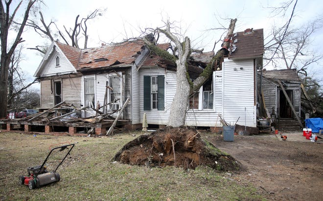
Forecasters on Saturday said the Northeast should brace for more snow and the southeast faced an upcoming threat of severe thunderstorms. Meanwhile, snow was falling in parts of the central U.S., where some were under winter weather advisories.
Here's what to know about the weekend weather forecast:
- Snow in Kansas, Missouri: Eight inches of snow had fallen in western Kansas by Saturday afternoon, the most in the region, according to AccuWeather meteorologists. By Saturday night, football fans attending an NFL playoff game in Kansas City, Missouri, should also get wintry precipitation from the storm.
- More snow in Northeast: Just days after the last storm, more snow is on the way. The storm is expected by Sunday night and will affect an interior swath of the northeast spanning from Pittsburgh to Maine.
- Severe storm risk in South: Forecasters predict severe thunderstorms spanning from east Texas to the Carolinas throughout next week. The heavy storms could bring damaging winds and possibly spur tornadoes and power outages.
On Saturday, the snow in the central U.S., particurally western Kansas was the most notable severe weather.
"By the time all is said and done, there's a pretty good chance that area is going to see anywhere from 6 to 12 inches of snow," AccuWeather senior meteorologist Mike Doll told USA TODAY.

Football fans in Missouri should prepare for slippery roads
There likely won't be any build-up of snow during Saturday night's NFL playoff game between the Jacksonville, Florida, Jaguars and the Kansas City Chiefs, Doll said.
But rainfall during the game will transition to snow afterwards and travelers should prepare for slippery roads, he said.
Through Sunday, the Kansas City metro region could get a total of two inches of snow on the ground, the weather service says.
Chicago could also get a bit of snow on the ground Sunday, Doll said.
Heavy snow will reach northeast by Sunday
A pair of winter storms will hit a wide swath of the eastern U.S. starting Sunday evening, weather service forecasters said Saturday.
More snow is expected into next week, and AccuWeather meteorologists say accumulating snow is likely from Missouri to Maine.
The Adirondacks, Catskills and other mountainous areas in New England could get the heaviest snow, with totals over six inches possible, AccuWeather forecasters said this week.
Wet snow will be paired with rain along the East Coast, forecasters said Saturday, with the I-95 corridor set to experience the storm as a "rain event," Doll said.
Major cities east of I-95 including Washington, D.C., Philadelphia and New York have received only "trace" amounts of snow this winter, AccuWeather reported, and residents there should plan ahead for next week with rain coats and boots, forecasters told USA TODAY.
Severe thunderstorm risk in the South next week
A swath of the south stretching from Houston to the Carolinas will see intense rain from thunderstorms that could bring tornadoes to the region for the second time this month.
Up to two inches of rain is possible along the Gulf Coast, in eastern Texas, Louisiana and Mississippi on Tuesday. Georgia and the Carolinas will likely feel the storm's impact through Wednesday night, AccuWeather reported Saturday.
Local flash flooding is possible and severe winds could bring power lines down and cause outages.
Parts of Texas, Oklahoma, Arkansas and Missouri could see snow and ice as a result of the massive storm, NWS forecaster Ashton Robinson Cook told USA TODAY on Saturday.
"We're expecting snow to occur on the north side of that system," he said.
Isolated tornadoes could turn deadly, as they did earlier this month in Alabama and Georgia, where at least seven people were killed as tornadoes inflicted serious damage across the states in mid-January.

Source link


