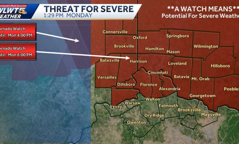
The Storm Prediction Center still has the Cincinnati area under a slight risk (level two of five) for severe weather Monday afternoon.LIVE RADAR // LATEST WEATHER ALERTSIt looks like we could see a window for a few strong to possibly severe storms during the late morning and afternoon (around 10 a.m. to 6 p.m.). For now, plan on being on weather aware as any storms that do become severe could contain gusty winds or an isolated tornado. It will also be windy for much of the day, with gusts topping out at 50 mph at times. Our highs will be around 65.The rain moves out after 6 p.m. but stays windy overnight with sustained winds from 15-25 mph.Tuesday will be sunny and cooler, but still great for the final day of February, with highs in the mid-50s. Wednesday brings highs back toward 70 in the afternoon before rain moves in around sunset Wednesday night.Thursday will be cooler, in the 50s, and we're watching a developing system headed in on Friday.Right now it looks warm enough for this to be mainly rain, but there's a chance for a mix or snow in sports.
The Storm Prediction Center still has the Cincinnati area under a slight risk (level two of five) for severe weather Monday afternoon.
LIVE RADAR // LATEST WEATHER ALERTS
It looks like we could see a window for a few strong to possibly severe storms during the late morning and afternoon (around 10 a.m. to 6 p.m.). For now, plan on being on weather aware as any storms that do become severe could contain gusty winds or an isolated tornado.
This content is imported from Twitter.
You may be able to find the same content in another format, or you may be able to find more information, at their web site.
This content is imported from Twitter.
You may be able to find the same content in another format, or you may be able to find more information, at their web site.
This content is imported from Twitter.
You may be able to find the same content in another format, or you may be able to find more information, at their web site.
It will also be windy for much of the day, with gusts topping out at 50 mph at times. Our highs will be around 65.
The rain moves out after 6 p.m. but stays windy overnight with sustained winds from 15-25 mph.
Tuesday will be sunny and cooler, but still great for the final day of February, with highs in the mid-50s.
Wednesday brings highs back toward 70 in the afternoon before rain moves in around sunset Wednesday night.
Thursday will be cooler, in the 50s, and we're watching a developing system headed in on Friday.
Right now it looks warm enough for this to be mainly rain, but there's a chance for a mix or snow in sports.
Source link


