TIMELINE: Severe storm threat moves in Thursday with hail, winds, tornado possible

Updated: 2:28 PM EST Feb 16, 2023
UNCONSTITUTIONAL AND UNPRECEDENTED. STEVEN: LET’S TALK ABOUT OUR WEATHER. IT YOU MAY LOOK OUTSIDE AND SEE CLOUDS. -- YOU MAY LOOK OUTSIDE AND SEE CLOUDS, WHICH IS WHAT YOU WANT TO SEE TODAY. RANDI: WE HAVE THE VERY INTENSE RAINFALL THIS MORNING. THE AIRPORT ALMOST PICKED UP TWO INCHES OF RAIN THIS MORNING. THE HEAVY RAIN DID ITS JOB HELPING THE TEMPERATURES DOWN. IT IS NOT ZERO. IT IS DEFINITELY NOT AS AGGRESSIVE IT LOOKED LIKE IT WAS GOING TO BE TODAY. THIS IS THE LIVE RADAR. OVER THE LAST COUPLE OF HOURS KEMAL OF THE HEAVY RAIN SHOWERS HAVE MOVED OUT AND WE WERE -- OVER THE LAST COUPLE OF HOURS, THE HEAVY SHOWERS HAVE MOVED OUT. RAIN HAS HELPED TO KEEP OUR ATMOSPHERE PRETTY STABLE. AS WE LOOK TO THE SOUTH, WE ARE SOUTH OF THE 75 SPLIT. SOME LIGHT RAIN SHOWERS FALLING AGAIN THROUGH OWEN COUNTY. A SPRINKLE ALONG 75 NEAR DRY RIDGE. TO THE EAST END PORTIONS OF MASON COUNTY IN KENTUCKY. ALL OF THIS MOVING TO THE EAST, BRINGING A COUPLE OF SHOWERS FOR RIPLEY AND MANCHESTER. AS WE GO THROUGH THE NEXT HOURS, MAINLY DRY BUT SHOWERS OUT THERE FOR SURE. SEEING A COUPLE OF RAIN SHOWERS THEY ARE. MAYBE A SPRINKLE TRYING TO DEVELOP NORTH OF BUTLER COUNTY AREAS TOWARDS WEST COLLEGE CORNER. I WANT TO SHOW YOU A SEVERE WEATHER THREAT. WE WENT INTO TODAY WITH A ENHANCE RIGHT OF SEVERE WEATHER, DROP DOWN TO A SLIGHT BITE MIDMORNING, NOW A MARGINAL THREAT FOR SEVERE STORMS. THAT DOES NOT MEAN WE ARE TOTALLY IN THE CLEAR, IT MEANS THE STORMS WOULD OVERCOME THE ATMOSPHERE TO BRING A STRONG STORMS LATER IN THE DAY. WHAT HAS GONE OUT, THE THREAT FOR FLASH FLOODING. LIKE GREATER CINCINNATI, THE 275 LOOP, WE DO HAVE THE POTENTIAL FOR ADDITIONAL RAINFALL THAT COULD CAUSE A FLASH FLOODING. AREAS TO THE SOUTH HAVE A BETTER CHANCE SEEING MORE INTENSE RAINFALL. A SLIGHTLY GREATER CHANCE TO SEE SOME FLASH FLOODING AS WE GO INTO THE AFTERNOON HOURS. OUR TEMPERATURE SITTING IN THE MID-50’S, WARM FRONT TO OUR SOUTH. AS WE GO THROUGH THE DAY, TEMPERATURES ARE LIKELY TO MAKE IT TO THE LOW 60’S INTO THE E EARLY AFTERNOON. NOW UNTIL 3 P.M., WE ARE IN THE LOW. RAIN SHOWERS ARE GOING TO START TO DEVELOP AS WE HAD INTO THREE AND 4 P.M. AS THE COLD FRONT GETS CLOSER. WE ARE ANTICIPATING RAIN AND THUNDERSTORMS. THEY JUST MAY NOT BE AS AMPLIFIED. A ISOLATED SEVERE STORM, VERSUS WIDESPREAD. THE POTENTIAL FOR FLOODING HAS GONE UP. BETWEEN FOUR AND 8 P.M., STILL THE POTENTIAL FOR RAIN AND STRONGER STORMS HAS THE COLD FRONT MOVES IN ABOUT NINE AND 11 P.M., THE STORM THREAT HAS FADED. THAT IS ONE YOU NOTICED THE TEMPERATURES TUMBLE AND RETURN TO A WINTER LIKE DEAL BY TOMORROW MORNING. HERE IS THE AFTERNOON. BY THE TIME WE GET TO THREE AND 4:00, STARTED TO SEE THE STORMS RAMP UP AGAINST THE WEST AND SOUTH. BY THE TIME WE GET TO 6:00 TONIGHT, THAT COLD FRONT SLIPPING THERE WITH A FEW FINAL SHOWERS IN THE 9:00 HOUR. THE COOLER AIR ARRIVES AFTER THAT, GIVING US TEMPERATURES DOWN IN THE 30’S TOMORROW MORNING. MAYBE EVEN A PASSING SLURRY THROUGH THE DAY ON FRIDAY. FLOOD WATCH IS IN EFFECT FOR MUCH OF GREATER CINCINNATI THROUGH 11:00 P.M.. AS WE GET DOWNPOURS THIS AFTERNOON, WATCH FOR AREAS OF HIGH WATER. RIGHT NOW WE HAVE MOSTLY CLOUDY SKIES, 55 DEGREES. NEARLY TWO INCHES OF RAIN THAT HAS ALREADY FALLEN THIS MORNING. WE ARE LOOKING AT CLOUDY SKIES RIGHT NOW. YOUR WINDOW FOR STORMS, MID AFTERNOON INTO THE EVENING. FADING AWAY AS WE GET INTO EIGHT AND 9:00 TONIGHT. WE DROP ALL THE WAY TO 30 DEGREES, THE RAIN PHASES OUT. IT BREEZY OVERNIGHT. TOMORROW, 38 FOR OUR HIGH. THE COLD AIR DOES NOT LAST ALL NIGHT LONG.
TIMELINE: Severe storm threat moves in Thursday with hail, winds, tornado possible
Updated: 2:28 PM EST Feb 16, 2023
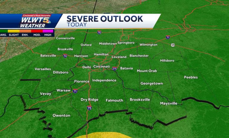
It's felt like spring, so its time to bring on the spring-like severe storm threat. The first round of rain packed a punch with many reports of high water on area roads for the morning commute. 1.82" of rain fell in CVG Airport before noon. We've hit the lull in the action between the first and second round of rain. LIVE RADAR // LATEST WEATHER ALERTS If the break is substantial and the skies brighten up, that will increase our threat for severe storms. If it stays gloomy and drizzly that's actually a good thing and should help limit the strength of the afternoon batch. So it is a little bit of a "wait and see" day for us. The best chances for strong storms at this point will be south of Cincinnati.For the second round between about 3 p.m. and 8 p.m., the cold front moves through. This brings a threat for additional flooding and some isolated strong to severe storms in Greater Cincinnati. These have the potential to bring gusty and damaging winds. There is also a low-end tornado threat in the afternoon. The more likely areas for tornadoes this afternoon are down in Tennessee, Mississippi and Alabama.After the front our temperatures tumble and we get another brief run in with winter temperatures for the first half of the weekend. Flurries will be possible on Friday with temperatures back in the 30s all day.
It's felt like spring, so its time to bring on the spring-like severe storm threat.
The first round of rain packed a punch with many reports of high water on area roads for the morning commute. 1.82" of rain fell in CVG Airport before noon. We've hit the lull in the action between the first and second round of rain.
LIVE RADAR // LATEST WEATHER ALERTS
If the break is substantial and the skies brighten up, that will increase our threat for severe storms. If it stays gloomy and drizzly that's actually a good thing and should help limit the strength of the afternoon batch. So it is a little bit of a "wait and see" day for us. The best chances for strong storms at this point will be south of Cincinnati.
For the second round between about 3 p.m. and 8 p.m., the cold front moves through. This brings a threat for additional flooding and some isolated strong to severe storms in Greater Cincinnati. These have the potential to bring gusty and damaging winds. There is also a low-end tornado threat in the afternoon. The more likely areas for tornadoes this afternoon are down in Tennessee, Mississippi and Alabama.
After the front our temperatures tumble and we get another brief run in with winter temperatures for the first half of the weekend. Flurries will be possible on Friday with temperatures back in the 30s all day.
Source link