Power outages: Thousands without power as gusty winds push through Cincinnati area

Updated: 3:09 PM EDT Apr 1, 2023
1046 ON THIS SATURDAY MORNING. THERE’S A LOT GOING ON TODAY. WE’VE GOT THE THIRD DAY OF OPENING DAY FOR THE KIDS. YOU GOT THE CINCINNATI MATCH LIKE I’M AFC COLORS ON TODAY. BUT IF YOU’RE GOING OUTSIDE, IT’S GOING TO BE WHEN THE LOOK AT THAT HIGHLAND MORNING RIGHT BEHIND YOU. THIS IS THE LATEST UPDATE HERE. YOU KNOW, WE STARTED THE DAY IN A WIND ADVISORY, BUT NOW THE NATIONAL WEATHER SERVICE HAS GONE AHEAD AND ISSUED AN UPGRADE TO OUR ENTIRE REGION WITH THOSE PEAK GUSTS POSSIBLE UP TO ABOUT 60 MILES AN HOUR. SO IT’S ONLY ABOUT A FIVE MILE AN HOUR DIFFERENCE BETWEEN AN ADVISORY THAT ABOUT 50, 55 MILE PER HOUR WINDS TO A WARNING AT 60 MILE AN HOUR. BUT THERE’S A LOT OF PEOPLE THAT MAY BE OUTSIDE RIGHT NOW CLEANING UP FROM LAST NIGHT’S STORMS. LOTS OF STICKS THERE IN THE YARD, THAT KIND OF THING. JUST KNOW THAT THESE ADDITIONAL STRONG WINDS IN THROUGH THE AFTERNOON COULD CAUSE MORE SMALL LIMBS TO SNAP, MAY CAUSE MORE POWER OUTAGES AS WE GO THROUGH THE AFTERNOON HOURS. SO HERE ARE TODAY’S ISSUES. I KNOW IT LOOKS BEAUTIFUL WHEN YOU PEEK OUTSIDE, SEE THAT NICE SUNSHINE? OUR TEMPERATURES ARE AT THEIR HIGHEST POINT RIGHT NOW AT 62 DEGREES. THEY ARE ABOUT TO TUMBLE VERY QUICKLY THROUGH THE FIFTIES INTO THE FORTIES AND WE SPEND MOST OF THE AFTERNOON IN THE FORTIES. COUPLE THAT WITH THOSE VERY STRONG WINDS, YOUR SUSTAINED WIND, YOUR STEADY WINDS OUT OF THE WEST, 20 TO 30 MILES AN HOUR. WE’RE LOOKING AT GUSTS AGAIN, 55 MILES AN HOUR, MAYBE SOME SPOTS REACHING 60 MILE AN HOUR WIND GUSTS THROUGH THE AFTERNOON. AND AS FAR AS RAIN GOES, THERE’S A CHANCE FOR A PASSING GUSTY SHOWER. BUT FOR MOST OF US, IT’S ALL ABOUT THE WIND. TODAY. SO AS WE LOOK AT THE RADAR HERE, YOU COULD SEE THINGS ARE QUIET AFTER THE OVERNIGHT STORMS MAY HAVE WOKEN UP. SOME OF THE LIGHT SLEEPERS IN YOUR HOUSE LAST NIGHT. THAT’S OFF TOWARD THE EAST COAST. WE’RE WATCHING THE SECONDARY FRONT THAT RIGHT NOW IS KEEPING THE FOCUS OF ANY SORT OF RAIN OFF TOWARD NORTHERN INDIANA, NORTHERN OHIO. THIS LINE HERE COULD DEVELOP BACK AND BRING US A PASSING SHOWER AS WE HEAD INTO THE EARLY AFTERNOON. BUT BETTER CHANCES, YOU’RE JUST GOING TO BE DEALING WITH THOSE STRONG WINDS. SO CURRENT WIND GUSTS HERE IN CINCINNATI, 30 MILE AN HOUR WINDS GUSTING OVER THE LAST HOUR. LOOK BACK TOWARD INDY. THEY’RE MORE IN THE 40 TO 45 MILE PER HOUR RANGE. SO THE STRONG WINDS HAVE ALREADY STARTED TO MOVE IN. AND AS WE GO THROUGH THE NEXT FEW HOURS, WE’RE GOING TO SEE THOSE PEAK GUSTS UP TO 55 OR 60 MILES AN HOUR INTO THE EARLY AFTERNOON. RIGHT NOW, 62 DEGREES. YOUR SUSTAINED WINDS, 20 MILES AN HOUR GUSTS CURRENTLY AT 32. WANT TO SHOW YOU THE AFTERNOON HERE. SO AT NOON, WE’VE ALREADY SEEN THOSE TEMPERATURES START TO DROP. WE’RE DOWN TO 56, ABOUT 40 MILE AN HOUR GUSTS. I THINK IT’S THE EARLY AFTERNOON, TWO, THREE, 4:00 WHERE YOU SEE THOSE WINDS GUSTING UPWARDS OF 50 MILES PER HOUR IN COMBINATION WITH TEMPERATURES TANKING DOWN THROUGH THE FORTIES. SO BY THE EVENING, THE WINDS ARE LIGHTNING UP, BUT OUR TEMPERATURES ARE ALREADY DOWN INTO THE LOW FORTIES. AND AS SKIES CLEAR OVERNIGHT, WE DROP ALL THE WAY DOWN TO AROUND FREEZING TOMORROW MORNING. FUTURE COURSE WILL SHOW OUR NICE BRIGHT SKIES WE HAVE RIGHT NOW REPLACED BY SOME CLOUDS AS WE HEAD INTO THE AFTERNOON AND WE HIT THOSE PEAK GUSTS IN THE EARLY AFTERNOON. FUTURE CARS PROBABLY A LITTLE OVER AGGRESSIVE WITH THE AMOUNT OF RAIN SHOWERS HERE, BUT A PASSING GUSTY SHOWER IS A POSSIBILITY INTO THE EVENING HOUR. WINDS DO SETTLE DOWN. THE HIGH WIND WARNING EXPIRES AT 6 P.M. THE WINDS OVERNIGHT GO FROM ABOUT 20 MILES AN HOUR AT SEVEN AND 8 P.M. DOWN TO FIVE MILES AN HOUR BY TOMORROW MORNING. COUPLED WITH THOSE COLDER TEMPERATURES. SO TODAY’S OBVIOUSLY WEATHER IMPACT DAY. WE’RE AT A HIGH OF 62 RIGHT NOW. TEMPERATURES ABOUT TO FALL INTO THE FORTIES. WE HAVE THAT HIGH WIND WARNING AND A CHANCE FOR A PASSING SHOWER. TONIGHT WE DROP DOWN TO 31. THE WINDS DIE DOWN, THE CLOUDS CLEAR OUT. BUT SUNDAY WILL BE A NICE DAY. 57 DEGREES FOR A HIGH DESPITE THE COLD MORNING. WE’LL HAVE A REALLY NICE AFTERNOON ON SUNDAY. GETTING INTO NEXT WEEK. SPRING BREAK LIKE TEMPERATURES AND YOU DON’T HAVE TO JUMP ON A PLANE TO GET THEM. WE’LL BE UP INTO THE SEVENTIES, MONDAY, TUESDAY AND WEDNESDAY. A FEW SHOWERS AROUND MONDAY MORNING AND THEN A SPOTTY SHOWER POSSIBLE. TUESDAY, THE BEST CHANCE FOR A THUNDERSTORM WOULD BE HERE ON WEDNESDAY FOR THE COOLER AIR TAKES OVER AGAIN B
Power outages: Thousands without power as gusty winds push through Cincinnati area
Updated: 3:09 PM EDT Apr 1, 2023
Thousands of customers are without power as strong winds push through the Cincinnati area.Currently, more than 8,000 customers are without power. The biggest impacts are in New Richmond, Crescent Springs and Newtown on Saturday afternoon.See latest power outages here There will be a little clean up in the wake of last night's round of rain with reports of some trees down in parts of our area.But we aren't done with the strong winds. In fact, some will see even stronger gusts Saturday than you experienced Friday night.There is a high wind warning for Saturday through 6 p.m. Sustained winds of 20-30 mph with those stronger gusts of 50-60 mph. The worst of the winds are likely through 4 p.m.Temperatures climbed to the low 60s in the late morning but are about to take a dive due to an approaching front sending temperatures into the 40s in the afternoon. Scattered showers will remain possible with the front, and of course, the gusty winds.See the latest forecast in the video player above.Sunday will be nice with sunshine and temperatures in the upper 50s in the afternoon.Next week brings in spring! Highs in the 70s on several days...but some threat for rain and storms.
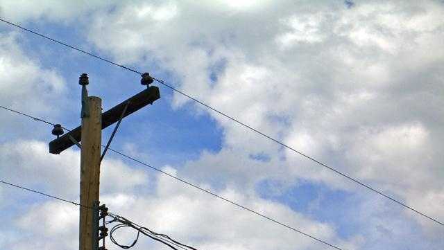
Thousands of customers are without power as strong winds push through the Cincinnati area.
Currently, more than 8,000 customers are without power. The biggest impacts are in New Richmond, Crescent Springs and Newtown on Saturday afternoon.
There will be a little clean up in the wake of last night's round of rain with reports of some trees down in parts of our area.
But we aren't done with the strong winds. In fact, some will see even stronger gusts Saturday than you experienced Friday night.
There is a high wind warning for Saturday through 6 p.m. Sustained winds of 20-30 mph with those stronger gusts of 50-60 mph. The worst of the winds are likely through 4 p.m.
Temperatures climbed to the low 60s in the late morning but are about to take a dive due to an approaching front sending temperatures into the 40s in the afternoon. Scattered showers will remain possible with the front, and of course, the gusty winds.
See the latest forecast in the video player above.
Sunday will be nice with sunshine and temperatures in the upper 50s in the afternoon.
Next week brings in spring! Highs in the 70s on several days...but some threat for rain and storms.
Source link