
Power outages are being reported Thursday morning across Greater Cincinnati as a powerful winter storm moves into the area.See the latest power outage map hereDuke Energy currently has over 800 reported outages. Most of the outages are currently in eastern counties and areas like Newtonsville and Woodland Park. There are several in the Springdale and Forest Park area.A major winter storm is moving into the Cincinnati area and is expected to create significant impacts on roadways.LIVE RADAR // LATEST WEATHER ALERTS // CLOSINGSSignificant impacts from a winter storm are expected Thursday through Friday. Travel is strongly discouraged after mid-morning Thursday.A winter storm warning for the entire WLWT viewing area is in effect through Friday morning.Radar will show a colorful picture to start the day Thursday, but what actually makes it to the ground initially will just be plain old rain. It will take some time for freezing rain to really stick to the roads as those pavement temperatures are above freezing.Don't let your guard down if you have a smooth pre-dawn commute, ice will begin to really stick to the pavement around sunrise. Spotty slick travel will be possible for the early morning drive (mainly on those bridges and overpasses), but worse road conditions are expected by mid-morning hours and into lunchtime.We'll likely see a time of heavy sleet as we push into the lunch hour and the afternoon. This will continue to deteriorate the roads across the region. Winds will be sustained to around 20 mph at times Thursday. This will create reduced visibility and sleet/freezing rain that comes down sideways.A wintry mix will begin to transition to snow through the I-275 loop and points west through the late afternoon and early evening Thursday. This is thanks to the colder air working in. Everyone sees snow through the overnight as temperatures drop to the teens.Snow continues through Friday morning. As of right now, the greatest accumulation of snow will be northwest of the 275 loop (north of 74 in SE Indiana and northernmost Butler County) with 4 to 6 inches or more possible.In and around the 275 loop and much of Greater Cincinnati will see more sleet than ice accumulation, then snow.Snow will end early Friday morning with accumulations around 1 to 3 inches.To the south and east of the I-71/75 split, the freezing rain lingers longer. This means the ice accumulation there could be 0.5 inches which causes power issues and roads turn to ice rinks. The snow totals there will be the lowest around an inch or so.Bitter cold will follow for Friday and the start of the weekend before thawing out Sunday.
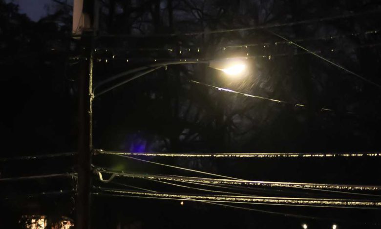
Power outages are being reported Thursday morning across Greater Cincinnati as a powerful winter storm moves into the area.
See the latest power outage map here
Duke Energy currently has over 800 reported outages. Most of the outages are currently in eastern counties and areas like Newtonsville and Woodland Park. There are several in the Springdale and Forest Park area.
A major winter storm is moving into the Cincinnati area and is expected to create significant impacts on roadways.
LIVE RADAR // LATEST WEATHER ALERTS // CLOSINGS
Significant impacts from a winter storm are expected Thursday through Friday. Travel is strongly discouraged after mid-morning Thursday.
A winter storm warning for the entire WLWT viewing area is in effect through Friday morning.
Radar will show a colorful picture to start the day Thursday, but what actually makes it to the ground initially will just be plain old rain. It will take some time for freezing rain to really stick to the roads as those pavement temperatures are above freezing.
Don't let your guard down if you have a smooth pre-dawn commute, ice will begin to really stick to the pavement around sunrise. Spotty slick travel will be possible for the early morning drive (mainly on those bridges and overpasses), but worse road conditions are expected by mid-morning hours and into lunchtime.
We'll likely see a time of heavy sleet as we push into the lunch hour and the afternoon. This will continue to deteriorate the roads across the region. Winds will be sustained to around 20 mph at times Thursday. This will create reduced visibility and sleet/freezing rain that comes down sideways.
A wintry mix will begin to transition to snow through the I-275 loop and points west through the late afternoon and early evening Thursday. This is thanks to the colder air working in. Everyone sees snow through the overnight as temperatures drop to the teens.
Snow continues through Friday morning. As of right now, the greatest accumulation of snow will be northwest of the 275 loop (north of 74 in SE Indiana and northernmost Butler County) with 4 to 6 inches or more possible.
In and around the 275 loop and much of Greater Cincinnati will see more sleet than ice accumulation, then snow.
Snow will end early Friday morning with accumulations around 1 to 3 inches.
To the south and east of the I-71/75 split, the freezing rain lingers longer. This means the ice accumulation there could be 0.5 inches which causes power issues and roads turn to ice rinks. The snow totals there will be the lowest around an inch or so.
Bitter cold will follow for Friday and the start of the weekend before thawing out Sunday.
Source link