Snow, sleet and ice are headed toward Greater Cincinnati.
The National Weather Service has issued a winter storm watch, in effect from 9 p.m. Wednesday until 7 a.m. Friday for portions of Southeast Indiana, Central and Northern Kentucky and South Central and Southwest Ohio.
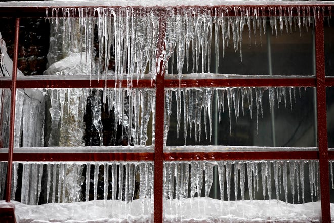
Heavy mixed precipitation is possible, with rain Wednesday night changing to rain and sleet early Thursday, then to freezing rain and sleet midday Thursday, then to snow and sleet late Thursday afternoon and finally entirely to snow Thursday night. Total snow and sleet accumulations of 2-4 inches are expected, along with ice accumulations of one quarter to one half of an inch, according to the National Weather Service.
More:Cincinnati Public Schools cancels school on Super Bowl Monday. Will other districts follow?
The weather could impact both the morning and evening commutes Thursday, as well as the morning commute Friday. Power outages and tree damage are likely due to the ice, and travel could be "nearly impossible."
In addition to the ice and hazardous conditions, the NWS predicts wind chills will likely fall below zero on Friday night.
Detailed Cincinnati forecast
Tuesday: Mostly sunny, with a high near 54. Tonight, a chance of rain mainly after 3 a.m. and new precipitation amounts of less than a tenth of an inch possible.
Wednesday: Rain, mainly after 7 a.m. and a high near 44. New precipitation amounts between half and three-quarters of an inch possible. Wednesday night, rain before 3 a.m., then rain and sleet.
Thursday: A high near 35. Rain and sleet before 9 a.m., then freezing rain and sleet between 9 a.m. and 4 p.m. Snow and sleet after 4 p.m., becoming all snow after 10 p.m. New ice accumulation of 0.2-0.4 of an inch and new snow and sleet accumulation of 2 to 4 inches possible.
Friday: Mostly cloudy, with a high near 24.
Saturday: Sunny, with a high near 29.
Sunday: Mostly sunny, with a high near 38.
Monday: Partly sunny, with a high near 35.
Source: National Weather Service, Wilmington.

Source link