
Enjoy two nice days this week before a major winter storm arrives in Greater Cincinnati.When you think "winter storm," snow is probably on your mind, but this one puts Cincinnati in play for all forms of winter weather from heavy rain to sleet and ice and yes, eventually some snow.By late Tuesday night, rain will begin arriving in the tri-state. Widespread rain, potentially heavy at times, will continue throughout the day on Wednesday. However, it's when a powerful cold front starts moving in Wednesday night when the big impacts begin.While the finer details are yet to be worked out, right now it looks like rain will start to change to freezing rain by early Thursday morning from northwest to southeast. It may take until later in the day before the cold push arrives in areas south of Cincinnati. There is the potential for significant ice accumulations.Even colder air will arrive by Thursday evening and night and change any remaining precipitation to a rain/sleet/snow mix and then all snow with some snow accumulation possible. Follow us closely these next few days as we are better able to pinpoint the finer details.
Enjoy two nice days this week before a major winter storm arrives in Greater Cincinnati.
When you think "winter storm," snow is probably on your mind, but this one puts Cincinnati in play for all forms of winter weather from heavy rain to sleet and ice and yes, eventually some snow.
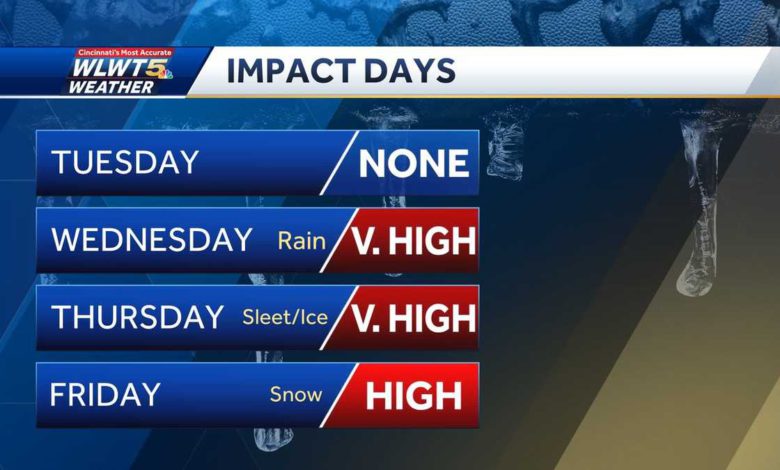
By late Tuesday night, rain will begin arriving in the tri-state. Widespread rain, potentially heavy at times, will continue throughout the day on Wednesday. However, it's when a powerful cold front starts moving in Wednesday night when the big impacts begin.
While the finer details are yet to be worked out, right now it looks like rain will start to change to freezing rain by early Thursday morning from northwest to southeast. It may take until later in the day before the cold push arrives in areas south of Cincinnati. There is the potential for significant ice accumulations.
Even colder air will arrive by Thursday evening and night and change any remaining precipitation to a rain/sleet/snow mix and then all snow with some snow accumulation possible. Follow us closely these next few days as we are better able to pinpoint the finer details.
Source link


