Snow showers to bring additional accumulations to the Cincinnati area Friday

Updated: 1:37 PM EST Jan 28, 2022
VACCINATED AND MORE THAN 3 MILLION ARE BOOSTED. TURNING NOW OURTO WEATHER, WE GOT A SNOWY WONDERLAND OVERNIGHT. SOMETIMES WHEN YOU HAVE TO GET OUT IN THIS, IT IS KIND OF A MESS. ALLIN: IT IS NOT FUN, AND I THINK THAT IS GOING TO CONTINUE THROUGH ISTH AFTERNOON AND THIS EVENING. ADDITIONAL ROUNDS OF SNOW ON THE WAY, BRINGING LOW VISIBILITY AND MORE SNOW COVER TO SOME OF THOSE ROADS ACROSS THE AREA. EARLIER THIS MORNING, THIS WAS WHAT WESTCHESTER LOOKED LIKE WITH THAT SNOW COMING DOWN. YOU NOTICE JUST HOW BIG THOSE SNOWFLAKES ARE. IT WILL CONTINUE TO BE THE CASE LATER ON THIS AFTERNOON. THIS WAS SENT TO ME BY CHRISTINA EARLIER. SO YES, WE STILL HAVE THE BENGALS PRIDE GOING ON TODAY EVEN TT WOULD -- EVEN THOUGH WE’VE GOT ALL THE SNOW TO TALK ABOUT. STILL HAVE A DECENT AMOUNT OF SNOW COMING DOWN TOWARDS THE DOWNTOWN AREA AND NOW THE EAST SIDE. THIS WAS NOT TOO LONG AGO CLOSER TO THE WEST SIDE, BUT NOW STARTING TO OVERSPREAD AREAS LIKE NORWOOD INTO OAKLEY, HYDE PARK, MADISONVILLE, COLUMBIA TUSCULUM, UNMO WASHINGTON TOWARDS ANDERSON TOWNSHIP, NEWTOWN ALSO SEEING SOME SNOW COMING DOWN AT A PRETTY GOOD CLIP. I ALSO WANT TO BRING TO YOUR ATTENTION THIS AREA OF SNOW CLEROS TO I 70. THIS IS GOING TO CONTINUE TO DIVE FARTHER TO THE SOUTH AND SOUTHEAST. THIS HAS THE POTENTIAL TO BRING AN ADDITIONAL INCH OF SNOW FALL TO SOM AREAS THROUGHOUT INDIANA, PARTSF O KENTUCKY, AND AREAS IN WESTERN HAMILTON COUNTY. WE HAVE A WINTER WEATHER ADVISORY THAT IS NOW IN PLACE UNTIL 10:00 TONIGHT TO TAKE THAT TOIN CONSIDERATION. WE WERE LOOKINATG SOME CAMASER EARLR.IE SOME ADDITNAL CAMERAS THERE. IN ADDITION TO THAT, IT WILL BRING WNDO VISIBILITY AT TIMES. WE HAVE SEEN VISIBILITY COME DOWN AT TIMES ALREADY TODAY. FOR THE NEXT COUPLE OF HOURS, SNOW SHOWERS CONTINUE HERE. MOST OF US AREN’T GOING TO SEE MORE THAN A HALF INCH OF SNOW OR SO,UT B SOME OF T AHEREAS THEY GET CAUGHT UNDER THAT HEAVIER BAND OF SNOW COULD PICK UP A FULL INCH. THIS IS AN IDEA OF WHAT RADAR LOOKS LIKE BY 4:00 THIS AFTERNOON, AND I THINK THAT SNOW IS GOING TO IMPACTRE AAS CLOSER TO FRANKLIN COUNTY, FAYETTE COUNTY, UNION COUNTY, STH OF 74, AND CLOSER TO BOONE COUNTY. IT IS ENTIRELY POSSIBLE THAT WE END UPEE SING SOME OF THAT SNOW REACHING INTO PARTS OF HAMILTON COUNTY, MAYBE EVEN BUTLER COUN AS WELL. ONCE WE GET TO ABOUT 9:00 TONIGHT, THE SWNO IS OUT OF HERE AND WE BEGIN TO DRY OUT. YOU WANT TO BE CAREFUL ONOA R THROUGHOUT THE REST OF TODAY AND POSSIBLY EVEN EARLY TOMORROW MORNING. THE OTHER SRYTO IS GOING TO BE HOW COLD IT IS GOING TO BE OUTSIDE. TEMPERATURES YET AGAIN NOSEDIVED TO ABOUT NINE DEGREES TOMORROW MORNING, AND WITH THE WI CHILL , WE ARE TALKING ABOUT IT FEELING MORE LIKE ZERO OUTSIDE AND EVEN SUBZERO AND SOME NE IGHBORHOODS. BACK TO DANGEROUSLY COLD TEMPERATURES EARLY TOMORROW MORNING. THEN THROUGHOUT THE REST OF SATURDAY, WE WILL SEE LOTS OF SUNSHINE. NOT MUCH IN THE WAY OF WARMING. TEMPERATURES TOMORROW ONLY TOP OUT AROUND 2OR5 SO DEGREES. THIS IS WHAT I AM TALKING ABOUT WITH THAT VISIBILITY. NORMALLY WE WOULD BE ABLE TO SEE OVER THE RIVER INTO KENTUCKY, BUT NOT SO MUCH RIGHT NOW. VISIBILITY CURRENTLY DOWTON ABOUT TWO MILES IN HAMILNTO, AND FARTHER TO THE NORTH IN WILMINGTON, VISIBILITY DOWN TO ABOUT FOUR MIL.ES WE ARE LOOKING AT PICKING UP AN ADDITIONAL CODING OF TO A FULL INCH OF SNOWLL TODAY ON TOP OF EVERYTHING WE’VE ALREADY GOTTEN SO FAR. SOME AREAS HAVE PICKED UP ABOUT AN INCH OF SNOW, OTHERS CLOSER TO THE 2.5 INCH RANGE, SO SOME OF US WALKING AWAY FROM TODAY WITH AN EXTRA THERE INCHES OR SO OF SNOW ON THE GROUND. AS WE HEAD INTO THE WEEKD,EN TEMPERATURES SATURDAY DROPPING DOWN TO ABOUT NINE IN THE MORNING, UP TO 25 TOROMROW AFTERNOON, 38 FOR THE HIGH TEMPERATEUR SUNDAY, AND BY MONDAY, TEMPERATURES REACH BACK INTO THE L 40’S, 50’S BY TUESDAY, BUT THEN CHECK THIS OUT, WE ARE GOING TO SEE TEMPERATURES CRASHING BY THE END OF THE WEEK, DOWN
Snow showers to bring additional accumulations to the Cincinnati area Friday
Updated: 1:37 PM EST Jan 28, 2022
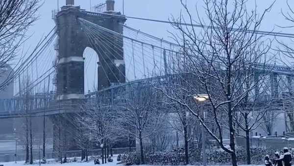
Many woke up to accumulating snow outside Friday, leading to some slick spots on the roads.An arctic front pushed through, bringing snow for the morning rush. Slow moving bands of snow developed overnight and many areas woke up to an inch or so of fresh snowfall.LIVE RADAR // LATEST WEATHER ALERTS // SCHOOL CLOSINGS The snow is not finished yet, additional rounds move in this afternoon, which could be heavy.A front moving into the area has the potential to bring up to an inch of additional accumulations to some areas throughout Indiana, parts of Kentucky and even some areas in western Hamilton County closest to the stateline. A Winter Weather Advisory is in place until 10 p.m. for those areas. This will bring down visibility and roads will get slick, especially as the sun sets. Another inch or so of snow is possible. The Cincinnati Police Department is under emergency accident reporting procedures until further notice. If you are in an accident and there are no injuries and the vehicles are drivable please exchange information, and continue on your way. or stop by any district.The temperatures are staying fairly steady most of the day in the 29 degrees to 30 degrees range. Then the front passes by, the clouds clear and even colder air spills in! Plan on coming down to the Banks to the Bengals Pep Rally from 4PM-7PM, dress very warm it will be in the low 20s with wind chills falling to the low teens, but lots of excitement to keep you warm! The weekend forecast will be dry and cold. Saturday starts out around 9 degrees. The high will be in the 20s with sunny skies. If you're hoping to catch the Bengals game outside Sunday, temperatures will be in the upper 30s. Kansas City will be a little warmer this weekend with a high of 50 degrees on Saturday and 46 degrees for the game on Sunday.Next week, we actually warm to the 50s by Tuesday. Watching the potential for a big drop in temperature and a switch from rain to snow later in the week. Stay Tuned!
Many woke up to accumulating snow outside Friday, leading to some slick spots on the roads.
An arctic front pushed through, bringing snow for the morning rush. Slow moving bands of snow developed overnight and many areas woke up to an inch or so of fresh snowfall.
LIVE RADAR // LATEST WEATHER ALERTS // SCHOOL CLOSINGS
The snow is not finished yet, more snow showers are rolling through Greater Cincinnati for the next few hours, bringing additional accumulations.
A front moving into the area has the potential to bring up to an inch of additional accumulations to some areas throughout Indiana, parts of Kentucky and even some areas in western Hamilton County. A Winter Weather Advisory is in place until 10 p.m. for those areas. Watch for another fresh coating and perhaps some reduced visibility.
The Cincinnati Police Department is under emergency accident reporting procedures until further notice. If you are in an accident and there are no injuries and the vehicles are drivable please exchange information, and continue on your way. or stop by any district.
The temperatures are staying fairly steady most of the day in the 29 degrees to 30 degrees range. Then the front passes by, the clouds clear and even colder air spills in!
Plan on coming down to the Banks to the Bengals Pep Rally from 4PM-7PM, dress very warm it will be in the low 20s with wind chills falling to the low teens, but lots of excitement to keep you warm!
The weekend forecast will be dry and cold. Saturday starts out around 9 degrees. The high will be in the 20s with sunny skies. If you're hoping to catch the Bengals game outside Sunday, temperatures will be in the upper 30s. Kansas City will be a little warmer this weekend with a high of 50 degrees on Saturday and 46 degrees for the game on Sunday.
Next week, we actually warm to the 50s by Tuesday, and a lot of rain before the end of the week!
Source link