LIST: Dozens of schools closed, delayed due to snow covered roads throughout Cincinnati

Updated: 8:25 AM EST Jan 28, 2022
MEGAN: I LOVET. I WE WILL CHECK BACK IN WITH YOU IF YOU’RE HEADED OUT, IT ALMOST DOES NOT MATTER WHERE YOU ARE IN THE REGION, YOU ARE PROBABLY SEEING SOME TYPE OF SNOW ACCUMULATING ON THE GROUND. RANDI: YESTERDAY, LATE EVENING, IT LOOKED LIKE HEAVIER BANDS WERE SETTING UP OVER TOP OF NORTHERN KENTUCKY. WITH THIS FRONT MOVING IN, IT IS DEVELOPING SNOW OVERHEAD. NO MATTER WHERE YOU ARE IN GREATER CINCINNATI, THE CHANCE ARE GOOD THAT YOU ARE LOOKING OUTSIDE -- CHANCES ARE GOOD THAT YOU’RE LOOKING OUTSIDE AND SEEING SNOWFL.AL ONCE NO HAS BEEN PERSISTENT FOR A IN SOUTHERN ADAMS COUNTY AND INTO MASON AND ROBERTSON COUNTIES. YOU CAN SEE THE LIGHTER SNOW BAND THA HAS SLOWLY BEEN TRAILING THE SOUTHEAST THROUGH THE 275 LOOP. THIS OTHER ONE TO THE NORTH IS MOVING A10T MILES PER HOUR, IN NTOORTHERN BUTLER COUNTY. I WANT TO SHOW YOU A ONE HOUR TIME LAPSE. YOU CAN SEE THE SNOW HAS BEEN CONSISTENT INSIDE THE 275 LOOP. LIGHT TO MODERATE SNOWFALL. LIGHT, FLUFFYLA FKES THAT ARE ACCUMULATING. THROUGH NORTHERN KENTUCKY, THIS IS ONE OF THE AREAS THAT HAD A HEAVIER BAND AROUND MIDNIGHT OR SO. THEY PKEICD UP AN INCH. ADDING TO THOSE TOTALS NOW, WITH E OWTH SHOWERS CONTINUING. GOING UTOP THE NORTHND A EAST, WILMINGTON AT ABOUT .5 INCHES AT 3:00 A.M. THEY ARE HEADED CLOSE TO THE ONE INCH LINE. I AM TRACKING THIS LINE HERE THAT HAS BEEN A SWLO MOVER, MOVING AT 10 TO 15 MILESER HOUR. THIS GIVES YOU A NICE LITTLE COINATG OF ACCUMULATION. IT IS MOVING TOWARD OKEANA AS WE GET TOWARD 10 AFTER 6:00. FAIRFIELD AT 6:45, BEFORE THE STEADIER BAND OF SNOW GETS TO YOU. YOU HAVE SEEN SNOW THERE AS WELL. ALONG THE OHIO RIVER, FROM MANCHESTER TO WRIGHTSVILLE AND VANCE BERG, THIS IS ONE OFHE T AREAS WHERE YOU SEE THIS DEEPER BLUE, IT HAS BEEN PARKED OVERHEADORHE F LAST 1.5 HOURS OR SO. I WOULD ANTICIPATE HIGHER SNOWFALL TOTALS. WASE LOOK AT THE WIDE VIEW, WE WANT TO SHOW YOU WHAT IS HAPPENING FOR THE NEXT COUPLE OF HOURS. THE FUTURECAST IS SHOWING SNOW SHOWERS, VERY SLOWLY TRAILING THROUGH THE AREA FOR THE MORNING RUSH. I THINK TTHA THOUGH IT IS NOT A HEFTY SNOWFALL, MOST OF US ARE PICKING UP AN TREX COATING TO MAYBE ONE INCH OF ACCUMULATION. IT IS COMING DURING THE MORNING RUSH. THAT CAUSES ITS FAIR SHARE OF ISSUES. THAT LINE SINKS TO THE SOUTH. TEMPERATURES STAY9 2 TO 30 DEGREES. WILL SEE AN OCCASIONAL FLURRY THROUGH THE LUNCH HOUR. THIS AFTERNOON, THROUGH OUR SOUTHERNMOST COMMUNITIES, THERE IS A POTENTIAL FOR REDEVELOPMENT. THAT COULD HAPPEN BETWEEN NOON AND 2:00 P.M. IT COULD CSEAU AREAS WHERE THE SNOW IS COMING IN SIDEWAYS AND MAY REDUCE VISIBILITY. WE WILL WATCH FOR THAT FOR THE SECOND HALF OF THE DAY. BY THE TIME WE GET TO THE HEART OF YOUR IDFRAY AFTERNOON AND EVENING, THE SNOW IS GONE AND THE CLOUDS ARE CLEARING O.UT THAT WILL SET US UP FOR A COLD START TOMORROW MORNING. ONCE AGAIN, WE ARE HEDGING DOWN TOWARD THE SINGLE-DIGIT TEMPERATURES WITH WIND CHILL’S TOMORROW MORNING BELOW ZERO. THIS MORNING, WE DON’T HAVE A WIND CHILL TO SPEAK OF. WE HAVE THE SNOW. 29 DEGREES AND TEMPERATURES THAT DON’T MOVE MUCH ALL DAY, UNTIL THE EVENING. THAT IS WHERE WE SEE THE BIG DROP IN TEMPERATURE AS THE SKIES CLEAR OUT. TODAY, 30 DEGREES AND MORNING SNOW. UP TO ONE INCH OF ACCUMULATION. LOOKING AT THE SEVEN DAY FOCAREST, THERE ISHE T NINE TOMORROW MORNING. 25 FOR THE HIGH. WE ARE WATCHING A DEVELOPING SYSTEM FOR NEXT WEEK. IT WILL PUSH IN WARMIR A AT FIRST. WE WILL SEE IF WE TRANSITION TO SNOW ON THE BACKSIDE OF THAT
LIST: Dozens of schools closed, delayed due to snow covered roads throughout Cincinnati
Updated: 8:25 AM EST Jan 28, 2022
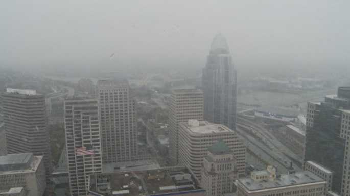
Many are waking up to snow showers Friday, leading to some slick spots on the roads.Dozens of schools are closed due to icy and slick conditions on the roads.LIVE RADAR // LATEST WEATHER ALERTS // SCHOOL CLOSINGSAn arctic front is pressing in and bringing snow for the morning rush. Slow moving bands of snow developed overnight and many areas woke up to around an inch of fresh snowfall.Watch for slick or snow covered side streets and rural routes for the morning rush. Most areas see the snow taper by noon, but there's the potential for snow to redevelop in the afternoon south of the I-71/75 split. Watch for another fresh coating and perhaps some reduced visibility.The Cincinnati Police Department is under emergency accident reporting procedures until further notice. If you are in an accident and there are no injuries and the vehicles are drivable please exchange information, and continue on your way. or stop by any district.The temperatures are staying fairly steady most of the day in the 29 degrees to 30 degrees range. Then the front passes by, the clouds clear and even colder air spills in!Plan on coming down to the Banks to the Bengals Pep Rally from 4PM-7PM, dress very warm it will be in the low 20s with wind chills falling to the low teens, but lots of excitement to keep you warm!The weekend forecast will be dry and cold. Saturday starts out around 9 degrees. The high will be in the 20s with sunny skies. If you're hoping to catch the Bengals game outside Sunday, temperatures will be in the upper 30s. Kansas City will be a little warmer this weekend with a high of 50 degrees on Saturday and 46 degrees for the game on Sunday.Next week, we actually warm to the 50s by Tuesday, and a lot of rain before the end of the week!
Many are waking up to snow showers Friday, leading to some slick spots on the roads.
Dozens of schools are closed due to icy and slick conditions on the roads.
LIVE RADAR // LATEST WEATHER ALERTS // SCHOOL CLOSINGS
An arctic front is pressing in and bringing snow for the morning rush. Slow moving bands of snow developed overnight and many areas woke up to around an inch of fresh snowfall.
Watch for slick or snow covered side streets and rural routes for the morning rush. Most areas see the snow taper by noon, but there's the potential for snow to redevelop in the afternoon south of the I-71/75 split. Watch for another fresh coating and perhaps some reduced visibility.
The Cincinnati Police Department is under emergency accident reporting procedures until further notice. If you are in an accident and there are no injuries and the vehicles are drivable please exchange information, and continue on your way. or stop by any district.
The temperatures are staying fairly steady most of the day in the 29 degrees to 30 degrees range. Then the front passes by, the clouds clear and even colder air spills in!
Plan on coming down to the Banks to the Bengals Pep Rally from 4PM-7PM, dress very warm it will be in the low 20s with wind chills falling to the low teens, but lots of excitement to keep you warm!
The weekend forecast will be dry and cold. Saturday starts out around 9 degrees. The high will be in the 20s with sunny skies. If you're hoping to catch the Bengals game outside Sunday, temperatures will be in the upper 30s. Kansas City will be a little warmer this weekend with a high of 50 degrees on Saturday and 46 degrees for the game on Sunday.
Next week, we actually warm to the 50s by Tuesday, and a lot of rain before the end of the week!
Source link