- A winter storm warning went into effect for most of the Chicago area into Sunday.
- In Kansas, a driver rear-ended a plow on I-135 while it was clearing snow.
- Up to 6 inches of snow could fall in some areas around Washington, D.C.
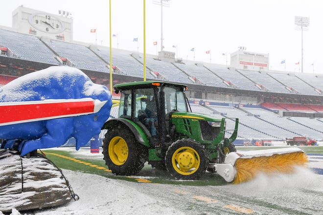
A winter storm roaring through a swath of the Midwest on Sunday pounded at least 18 states and was poised to blast parts of the East with their first major snow of the season.
Farther south, a line of severe weekend storms damaged homes, knocked out power and downed trees in parts of Kentucky and Alabama. Portions of eastern Kentucky, Tennessee, Arkansas, Louisiana, Mississippi and Alabama spent much of the weekend under a tornado watch.
Missouri, Kansas, Iowa, Illinois and Michigan were among states getting heavy snow, AccuWeather reported.
A winter storm warning went into effect for most of the Chicago area Sunday, and the city had more than 4 inches of snow by early morning. More than 1,000 flights were canceled at O'Hare and Midway international airports Saturday. Flight operations were suspended by Southwest Airlines at both airports because of the snow.
Chicago's heaviest snows this winter ushered in some of the coldest weather.
"Coldest night so far this winter tonight!" the National Weather Service in Chicago tweeted Sunday. "Away from the lake and city, the actual air temperatures will drop below zero, with double digit subzero lows possible at a couple of the typically coldest locations. Winds will be light, but enough for bitter cold wind chills!"
'TREACHEROUS START TO 2022': Storm brings flooding, lost power, possible tornado to the South
In Michigan, the Grand Rapids airport reported 5.7 inches of snow Sunday morning. Lansing had 5.1 inches.
"This snow will stick around," the weather service in Grand Rapids warned. "Temperatures will stay below freezing until maybe Tuesday, then more cold air comes in after that."
In Kansas, a car rear-ended a plow on I-135 while it was clearing snow. The driver of the car was transported to a hospital with non-life-threatening injuries. Icy roads plagued Kansas, causing several slide-offs and crashes near Emporia.

In Iowa, a section of I-80 near Burlington was closed Saturday night after a truck jackknifed westbound as the snow fell, the Iowa State Patrol said.
The storm responsible for a swath of accumulating snow for thousands of miles in the Southwestern and Central states this weekend will bring cold air into the central and southern Appalachians and Northeast early this week. The jet stream will remain in a southwest-to-northeast configuration and allow a storm from the south to ride northeastward as the cold air locks in, AccuWeather said.
COLORADO SNOW: Snow covers fire-scarred Denver suburbs
In the East, temperatures climbed toward record highs in the 60s on Sunday. But a dramatic change was forecast overnight, and a winter storm watch was issued for much of the Washington and Baltimore area.
Federal offices and public schools in Washington, D.C. both preemptively closed on Monday.
The National Weather Service warned of snow accumulations of 3 to 7 inches and winds gusting as high as 35 mph.
"The ingredients are in place for part of the mid-Atlantic to have snow fall at a heavy rate of 1-3 inches per hour for a time on Monday," AccuWeather meteorologist Ryan Adamson said. Questions remain as to how far north the snow will extend.
The same storm will sweep across parts of Tennessee and the southern Appalachians, AccuWeather said.
Snow touched down in Nashville on Sunday night, according to the National Weather Service.
"Cities such as Nashville, Tennessee, and Asheville, North Carolina, are likely to pick up a few inches of snow from the storm," AccuWeather meteorologist Nicole LoBiondo said.
Contributing: The Associated Press


