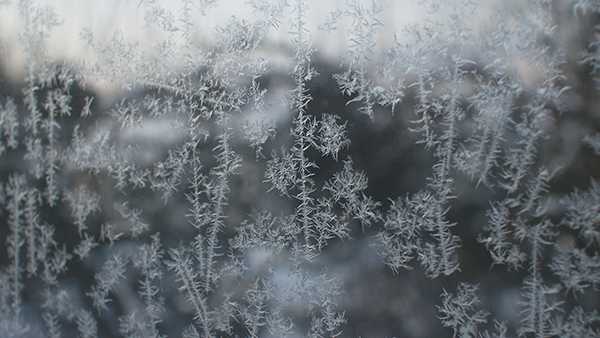
Threat for first frost of season: Frost advisory issued overnight for Greater Cincinnati

Updated: 7:20 PM EDT Oct 26, 2021
FOLLOW THE UNVACCINATED PROTOCOLS AND TAKE A TEST THE DAY BEFORE YOUR FLIGHT. MI: WELL, IF YOU ARE A FAN OF FALL, YOU COULD FREEZE THE TEMPERATURE. RIGHT NOW WOULD BE A TEMPERATURE NOT TOO BAD WITH THE SUNSHINE. THE PROBLEM IS, THAT IS NOT WHERE IT IS GOING TO STAY INTO THE NIGHT TONIGHT, KEVIN. KEVIN: YOU HAVE TO BE A FAN OF FALL, TOO. [LAUGHTER] MIKE: I AM. HUGE FAN. KEVIN: IT’S NOT TOO COLD FOR YOU? MIKE: I LOVE IT. KEVIN: HOW ABOUT 30’S? MIKE: EH. [LAUGHTER] VIKE WE HAVE THE THREAT FOR FROSTO S FAR THIS SEASON, SO YOU PROBABLY NEED TO ASK TO PROTECT THE PLANTS SENSITIVE TO THE COLD. WITH THAT IN MIND, WE HAVE A FROST ADVISORY IN EFFECT FOR THE ENTIRE WLWT VIEWING AREA. IT IS HONESTLY THE FIRST OF THE SEASON, IT LOOKS LIKE OVERNIGHT LOWS TONIGHT WILL GET DOWN GENERALLY INTO THE MID 30’S, BUT IF YOU LIVE KIND OF IN A VALYLE OR SHELTERED AREA, IT COULDE B A COUPLE OF DEGREES COLDER. YOU COULD ACTULYAL TEETER NEAR THE FREEZING MARK LATE TONIGHT AND FIRST THING TOMORROW MORNING. SO UNDOUBTEDLY THE COOLEST NIT,GH CHILLIEST NIGHT OF THE FALL SEASON WE HEAV EXPERIENCED SO FAR COMING UP, AND PART OF THAT IS DUE TO THE FACT THAT WE WON’T HAVE VERY FALL TO FALL. ITAS H ALRDYEA -- FARO T FALL. IT HAS ALREADY BEEN A COOL AFTERNOON OUT THERE. IT LOOKS LIKE ANOTHER SOAKER, A DECENT SOAKING EXPECTED THURSDAY INTO FRIDAY FOR THE TRI-STATE. RAIN IMPACTS ARE HIGH FOR THE END OF THE WEEK. THAT LINGERS INTO THE STA ORTF YOUR FLYING PIG WEEKEND. MORE ON THAT IN JUST A MOMENT. HIGH-PRESSURE SWEEPS ACROSS THE OHIO VALLEY TONIGHT. HERE IS A LOOK AT FUTURECAST. HIGH CLOUDS THIS MORNING, BUT THESE ARE TOO THIN. THEY WILL NOT DO ANYTHING TO HELP PROTECT US FROM THE COLD OVERNIGHT. A BEAUTIFUL DAY TOMORROW WITH PLENTY OF FILTERED SUNSHINE AROUND THE AREA. WE REALLY START TO CLOUD UP WEDNESDAY NIGHT. IT SHOULBED DRY WHEN YOU WAKE UP FIRST THING THURSDAY MORNING, BUT NOT FOR LONG. I THINK RAIN OVER SPREADS THE TRI-STATE PROBABLY BY LATE MORNING. BY 10:00, 11:00, I THINK RAIN IS SPREADING INTO THE METRO AREA, AND ESSENTIALLY, WE DEAL WITH RAIN ANDHE T TRI-STATE OFF AND ON THRGHOU PROBABLY EARLY SATURDAY MORNING. THAT IS WHY I SAY AS WE GET INTO THE FLYING PIG WEEKEND, THE WEATHER FOR FRIDAY NIGHT, NOT THE BEST ON SATURDAY MORNING. THE ONLY SILVER LINING SATURDAY MORNING, I THINK THAT IS A STEADY SOAKING WILL HAVE ENDED BY THEN, BUT SOME MIR,NO MISTY SHOWERS AROUND. I DON’T SEE ANY WEATHER CONCERNS WHATSOEVER. IN FACT, REAYLL CLOUDY FOR THE XTNE FORECAST, THAT COULD RIVAL SOMEF O THE CONDITIONS THAT WE SEE WHEN WE TYPICALLY HOST THE FLYING PIG DURING THE MONTH OF MAY. THE FIRST WEEKEND OF MAY. A LITTLE COOLER TO START OUT, CHILLY NIGHTS FOR THE RUNNERS OUT THERE. ALL RIGHT, SETNGTI SUN, KEEP AN EYE ON THE DEW POINT FOR THIS TIME OF YEAR, RELAXING WINDS. THE ACALTU TEMPERATURE LIKES TO MAKE A RUN FOR THE DEW POINT NUMBER. MOST OF US ARE WITHIN A DEGREE ORWO T OF 55 RIGHT NOW. WE ARE ABOUT TO STTAR FALLING WITHIN THE HOUR. WE QUICKLY GET DNOW TO THE MID-30’S BEFORE THE SUN COMES UP FIRST THING TOMORROW MORNING. ABTOU 77 HERE IN THE METRO. OUT INHE T ’BUS,RB PROBABLY AS COLD A35S OR 34. WHEN THE SUNS I UP, HERISE YOUR 7-DAY FORASECT. HERE IS YOUR WEATHER IMPACTAY D, THURSDAY, FRIDAY.
Threat for first frost of season: Frost advisory issued overnight for Greater Cincinnati
Updated: 7:20 PM EDT Oct 26, 2021
We have the threat for our first frost of the season overnight, followed by a soaking rain Thursday through Saturday, which will bring one to two inches of rain.Under clear skies Tuesday night and light winds, temperatures will tumble into the 30s. A frost advisory has been issued overnight from midnight to 10 a.m. Wednesday. You'll need to bring the potted plants inside for tonight. Get ready to turn the heat on, too!Our next round of rain arrives mid-morning Thursday and continues off and on into Saturday. Rain will be heaviest and steadiest Thursday night into Friday. It will be cool and wet for high school football playoffs Friday night, and the 50 West Mile to start the Flying Pig festivities. Temperatures will hold steady in the 50s.Expect lingering showers Saturday, but drying out by afternoon. That means good news for the Flying Pig and trick or treat Sunday! The weather is looking beautiful and sunny. Sunday morning temperatures will be in the 40s to start the race, low 60s by afternoon, and back in the 50s for trick or treat.
We have the threat for our first frost of the season overnight, followed by a soaking rain Thursday through Saturday, which will bring one to two inches of rain.
Under clear skies Tuesday night and light winds, temperatures will tumble into the 30s.
A frost advisory has been issued overnight from midnight to 10 a.m. Wednesday. You'll need to bring the potted plants inside for tonight. Get ready to turn the heat on, too!
Our next round of rain arrives mid-morning Thursday and continues off and on into Saturday.
Rain will be heaviest and steadiest Thursday night into Friday. It will be cool and wet for high school football playoffs Friday night, and the 50 West Mile to start the Flying Pig festivities. Temperatures will hold steady in the 50s.
Expect lingering showers Saturday, but drying out by afternoon. That means good news for the Flying Pig and trick or treat Sunday!
The weather is looking beautiful and sunny. Sunday morning temperatures will be in the 40s to start the race, low 60s by afternoon, and back in the 50s for trick or treat.
Source link