At least six people were killed and 65 others hospitalized – including frontline health care workers just getting off their shifts – in a massive chain-reaction crash that involved more than 100 vehicles on an icy Texas interstate Thursday.
Mike Drivdahl, a public information officer for the Fort Worth Fire Department, told USA TODAY that first responders had to rescue multiple people from their vehicles on I-35 using hydraulic tools. In addition to the fatalities, injuries ranged from minor to critical, and some people were transported to area hospitals.
Matt Zavadsky, a spokesman for MedStar, which provides ambulance service for the area, said at an afternoon press conference that some victims were in scrubs or had hospital IDs on.
"If you think about the timing of the crash and the people who can't opt not to travel, it's going to be your frontline health care workers," he added. "In some cases, our folks would know those folks."
Drivdahl called the pileup "a major catastrophe in our city."
"It's not a normal accident that we work on a regular basis," he said at the press conference. "It's not a fender-bender."

The crash happened as a frigid storm dropped ice and snow along a 1,500-mile swath of land for much of Thursday from Texas to southern New Jersey, triggering widespread power outages and dangerous road conditions. It could bring up to half an inch of ice accumulation in some areas, the weather service said.
"A mixture of sleet and freezing rain is forecast to gradually come to an end today, but not before leaving a long swath of damaging ice accumulations," the weather service said.
Farther south, in Austin, five people were hospitalized after a 26-vehicle pileup on an icy highway, emergency officials said. "This cannot be overstated today," the National Weather Service in Austin tweeted Thursday morning. "PLEASE, DO NOT TRAVEL in the Hill Country and northern I-35 corridor. Conditions will continue to deteriorate as elevated roadways ice over first, followed by other roads."
The Ozarks to the I-64 corridor in eastern Kentucky could see a quarter-inch of ice, according to the weather service.
"This amount of ice will likely lead to hazardous travel conditions, power outages and scattered tree damage," the weather service said in a forecast.
More than 66,000 customers in Texas, 41,000 in Kentucky and 31,000 in West Virginia were without power late Thursday night, according to tracking website PowerOutage.us.
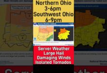
Through Friday, the storm is forecast to bring light snow to the Ohio Valley and Central Appalachians to the Mid-Atlantic, which could see 2 to 6 inches, according to the weather service.
More freezing rain is possible Friday for the central Appalachians and parts of Virginia and northern North Carolina, the weather service said.
“Accidents and icy conditions could potentially shut down portions of highways for an extended period,” AccuWeather senior meteorologist Paul Walker said.
In Kentucky, the severe weather resulted in schools, COVID-19 vaccination sites and state offices closing. Louisville's MetroSafe reported 10 crashes from 5 to 7 a.m. Thursday, including a wreck on I-64 that resulted in injuries. Wednesday saw 70 crashes from 1 to 10 p.m., including 17 with injuries.
Memphis woke up Thursday morning with a fresh blanket of ice slush on the roads and sagging tree limbs heavy with a sheath of frozen precipitation. Wednesday evening into Thursday morning, there was a rare appearance of "thunder ice," or a thunderstorm with freezing rain or ice.
Amid light snow Wednesday evening, an airplane with nearly 80 passengers slid off the runway at Pittsburgh International Airport, the Pittsburgh Post-Gazette reported. There were no injuries.
A light dusting of snow that fell overnight blanketed cars and sidewalks in New York City on Thursday morning.
The weather service said gusty winds could cause damage Thursday into Friday, and bitterly cold temperatures are expected into the weekend.
In Dallas, that cold air blast could lead to the Texas city's first snowfall of the season Sunday, AccuWeather said.
"Anytime you get an Arctic air mass into Texas, you always have to worry about snow and ice because, at some point, warmer air is going to try to return. And when warmer air collides with that colder air, you get clouds and precipitation,” AccuWeather chief on-air meteorologist Bernie Rayno said.
The Pacific Northwest was also expected to see "impactful winter weather" through Saturday, the weather service said.
"A low-pressure system is forecast to enter southern Oregon this evening while simultaneously interacting with very cold air draining into the region. This combination may lead to not only heavy snow across the typical mountainous locations, but in the lowlands as well," the forecast said.
Seattle and Portland could see some snow: AccuWeather predicted 1-3 inches in both cities.
Contributing: Billy Kobin, Louisville Courier-Journal; Micaela A. Watts, Memphis Commercial Appeal; The Associated Press


